Wimpy fronts and record heat possible through the end of the year!
12-26-24. 4:45pm. This Update is brought to you by Bahia Services and Rentals in Port O'Connor, TX https://www.facebook.com/BahiaServicesandRentals
I hope everyone had a great Christmas, and I know that at least a few of you got the best present one could hope for…some big rain totals! As forecast, some hefty storms formed just to the east of San Antonio, and swept SE during Christmas Eve, dropping over 5 inches of rain in places, along with some large hail in Falls City. Here are the totals from south-central Texas on the 24th: IEM :: PNS from NWS EWX.
A few more of you saw some light rain today, but for the most part, the main activity stayed to our east today and is now impacting Houston as I type this post.
Looking at the latest model data this afternoon, if you like warmer than normal temperatures and no rain, you’ll love the weather for the rest of the year! Del Rio saw a record high of 80 degrees today. We’ll see another wimpy dry front on Saturday night after hitting upper 70’s and 80’s during the day. Highs on Monday may reach or break records, with highs in the 80’s and possibly some 90’s in SW Texas before another wimpy front limps through. Finally, by New Years Day, a booster front zooms in and by Thursday morning of next week, it may actually feel like winter with lows in the 30’s and highs in the 50’s and 60’s.
If you were one of the lucky rain lottery winners, let us know how much rain fell at your place and where!
Mark

This Update is brought to you by Bahia Services and Rentals in Port O'Connor, TX https://www.facebook.com/BahiaServicesandRentals

72hr rainfall totals.

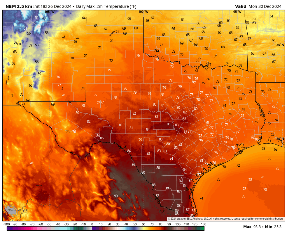
High temperatures on Monday may break records!
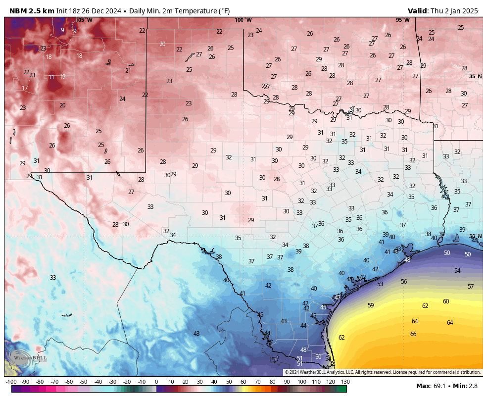
After a booster front on New Years Day, it will chill down to the 30’s and 40’s (a few 20’s in the Hill Country) by Thursday morning of next week.

Unfortunately, none of the models are forecasting much, if any rain south-central or south Texas through January 6th.