Slight chance for severe storms on Thursday night…
3-5-24 6pm. This update is brought to you by 5E Trailers in Marion. They’re here to help you find the perfect trailer at the best price! https://www.5etrailers.com/
As advertised yesterday, it was a hot one out there, especially for early March. Most locations in south-central and south Texas hit the upper 80’s to low 90’s! Expect another warm day on Wednesday, but hopefully in the 80’s instead of the 90’s.
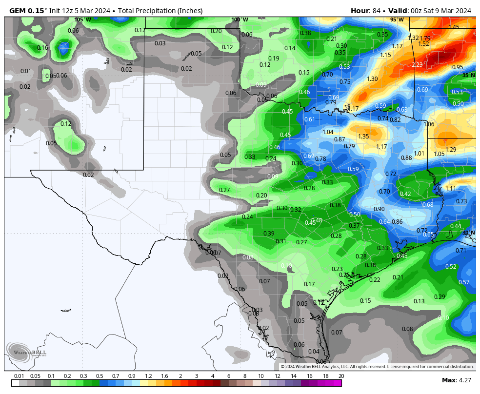
Thursday will start out will low clouds and some drizzle, but by the late afternoon and evening, we should start seeing some wildly scattered storms forming ahead and along our next cool front. As of this post time, most of the activity will stay in the Hill Country and points northward, but there is still a chance some areas to the south may also get in on a few storms. The main threat will be hail and high winds.
Once the front pushes through on Friday, look for some fantastic weather for the weekend, with lows in the 40’s and highs in the upper 60’s to low 70’s. Our next chance for rain will come around the 13th.
Mark
This update is brought to you by 5E Trailers in Marion. They’re here to help you find the perfect trailer at the best price! https://www.5etrailers.com/
Today’s high temperatures.
Areas in yellow have the greatest risk for a severe storm on Thursday night.
How much rain these models are predicting between Thursday and Friday.


