Our drought should improve next week!
1-24-25. 3pm. This Update is brought to you by 5E Trailers in Marion. They’re here to help you find the perfect trailer at the best price! https://www.5etrailers.com/
Looking over the latest model runs, I’m hoping we will see at least a dent in our omnipresent drought conditions, thanks to a breakdown of the evil high pressure over the west and a Baja low that will develop next week. Our first rainmaker will be a wimpy front that will slip through our area on late Saturday and early Sunday morning. This front will spark some showers and thunderstorms, but as I indicated yesterday, most of the rain will fall along and east of I-35 and I-37. I have included model forecasts below on how much rain to expect from this first system.
Our main player will be that closed low that will form in Baja, Mexico early next week. As it slowly moves east, it will send out disturbances, opening up a rain window from Tuesday night through Friday. As of today, this second rainmaker looks fantastic, with some models forecasting 2-3 inches!
FYI: I’m not seeing any arctic air on the horizon.
Below are all of the latest-greatest model runs…enjoy!
Mark

This Update is brought to you by 5E Trailers in Marion. They’re here to help you find the perfect trailer at the best price! https://www.5etrailers.com/
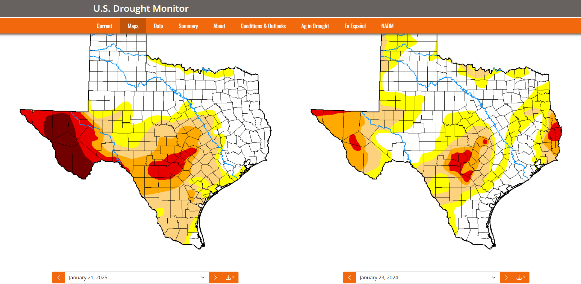
The latest drought and rainfall update. Click on images to see them larger.


Our early Sunday morning front will spark a few showers and thunderstorms, mainly east of I-35 and I-37.
How much rain we could see from our weekend wimpy front. Click on images to see them larger.


A Baja low is forecast to form early next week, giving us great chances for rain.
How much rain we could see from Tuesday through Friday of next week. Click on images to see them larger.


The California fires may finally go “poof” next week, thanks to rain moving into that area.

