Is a polar vortex coming?
12-28-24. 3:15pm. This Update is brought to you by Jack Garrett and Phase II Fertilizer. Phase II, Inc. was founded in 1994 with a mission to Help Family Farmers & Ranchers Thrive. You can reach Jack at 361-275-4841.
OK…there’s been a lot of hype and discussion on whether a Polar Vortex will be coming our way next month!
First let’s look at what’s happened today so far. A dryline moved through this morning and spawned a line of thunderstorms that extended from just NW of San Antonio to NE along I-35. The storms to the south dropped a little rain around San Antonio but were much stronger as they moved through the Austin area. There were reports of 3/4-inch hail not far from the airport and some rain totals that approached an inch. As the storms marched eastward, there were multiple reports of tornadoes and large hail in the Houston area…this is twice in a week they have had severe storms!
Once the dry air moved through, temperatures ramped up quickly, with many locations already in the low to mid 80’s as I do this post! Temperatures will be a little lower tomorrow, then jump back to the mid to upper 80’s on Monday, ahead of our next wimpy front. As mentioned yesterday, a strong front moves through early Wednesday, lowering our highs to the 50’s and 60’s from Wednesday through Friday of next week, with lows in the 30’s and 40’s.
Now let’s talk about the potential for an arctic outbreak, or Polar Vortex! As of this post time, the Euro model is predicting some arctic air to move through the US around the 7th-9th, with a portion of it dipping into Texas for a few days. The GFS also believes arctic air is on the way around the same time, but sends the brunt of it to our east, leaving us with only what we would call a strong cold front. The latest CPC outlook for the same time period, is keeping the coldest air to our east, like the GFS model. The other models don’t extend that far out as of today, so I’ll keep updating this potential fridged outbreak. If you are seeing scary Polar Vortex posts from other weather people, just remember that they are viewing the same data as I am and no one as of today can say for sure if this will actually impact us.
Mark

This Update is brought to you by Jack Garrett and Phase II Fertilizer. Phase II, Inc. was founded in 1994 with a mission to Help Family Farmers & Ranchers Thrive. You can reach Jack at 361-275-4841.

Rainfall totals from this morning’s storms.

Rainfall totals from this morning’s storms for the Austin area.


High temperatures so far as of post time.
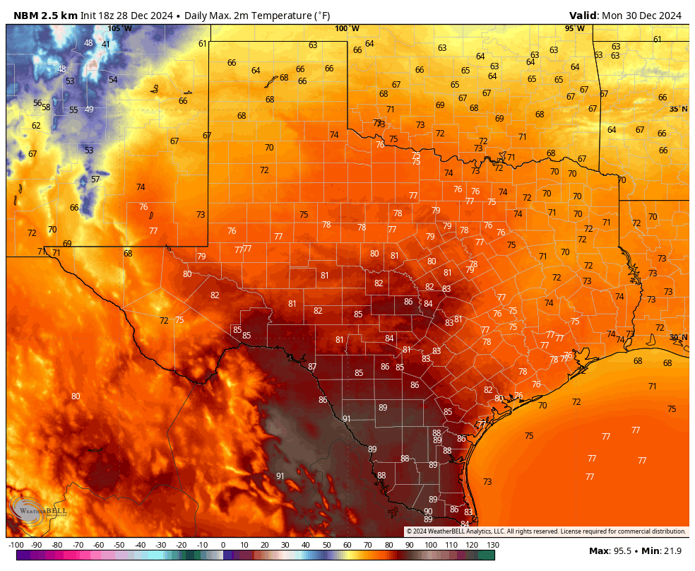
Forecast highs for Monday.
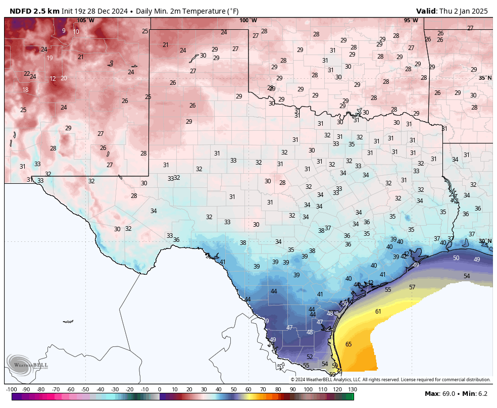
Forecast lows for Thursday morning.

None of the models are forecasting any meaningful rain through the 8th of January.

Oh no! Our toilet paper and water will be gone soon with rumors of a possible Polar Vortex next month! AI illustration by Mark Langford.

Severe Weather Europe is forecasting a Polar Vortex in early January.
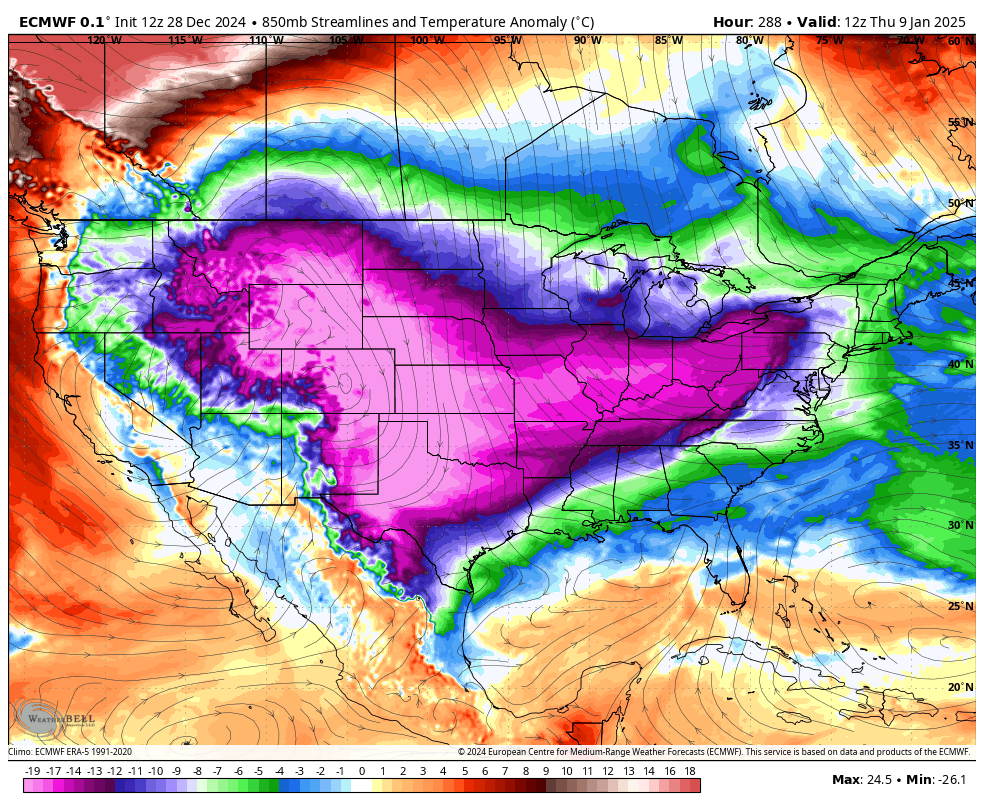
The latest Euro model is forecasting arctic air (in purple) moving into Texas around the 7th-9th of January.
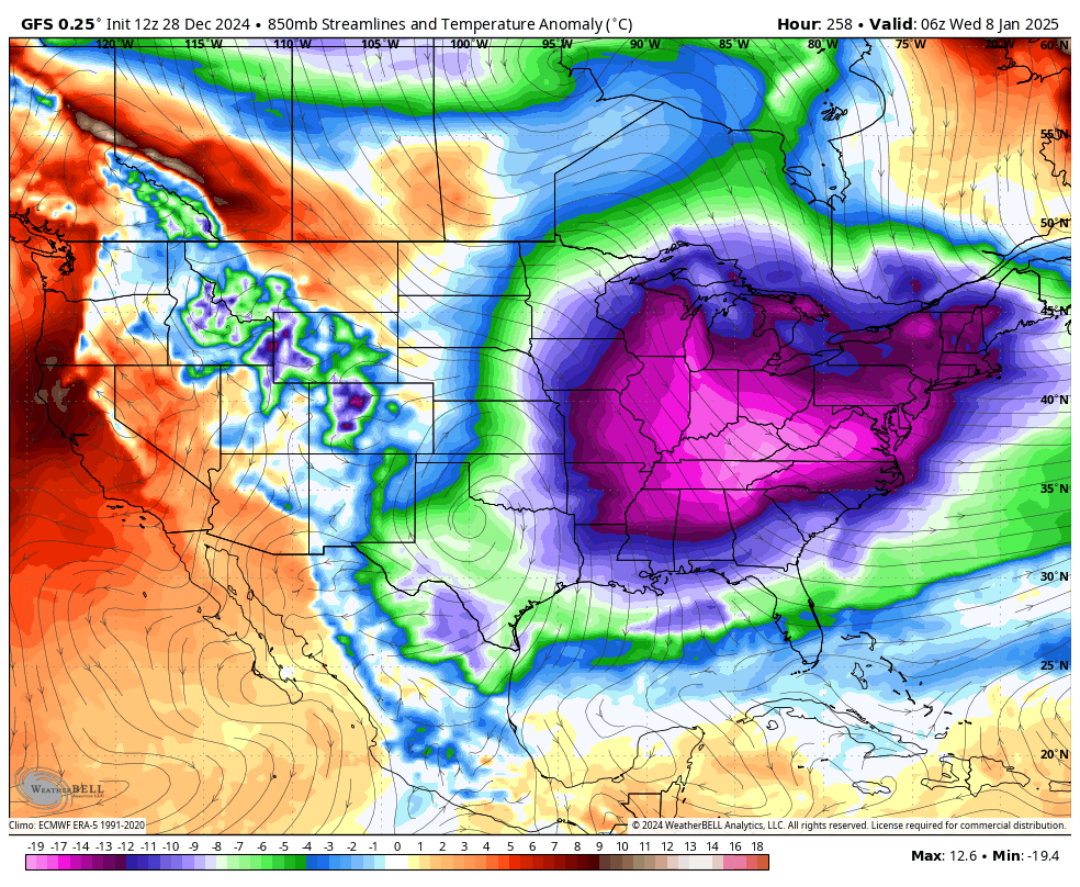
The latest GFS model is forecasting arctic air (in purple) moving into the NE around the 7th-9th of January.
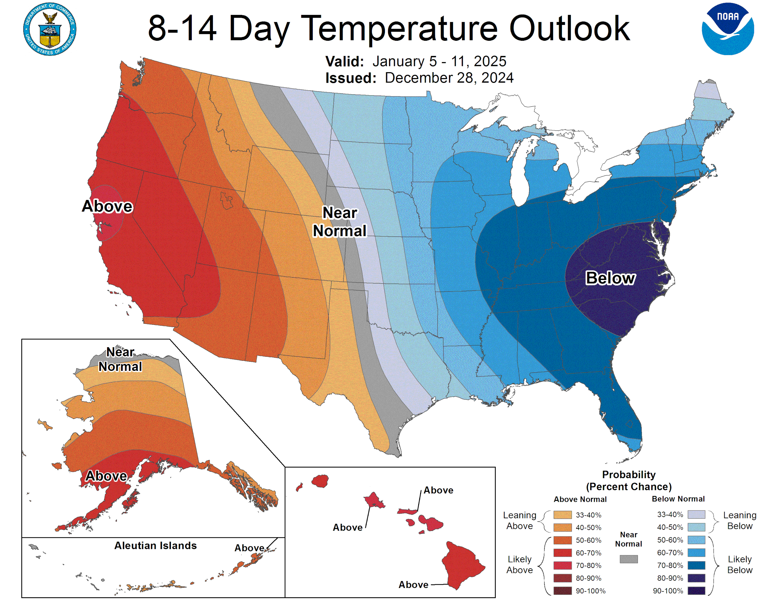
The latest 8-14 day CPC outlook is keeping the cold air to our east.

Forecast highs from the Euro model for January 10th…remember, this model will likely change its mind several times before this date!