No joking, this could get rough…
1-14-24. 3pm. This Update is brought to you by Bahia Services and Rentals in Port O'Connor, TX https://www.facebook.com/BahiaServicesandRentals
Over the past 24hrs I have been reviewing model runs and special statements from the NWS and I’m not liking what I see. Unlike our last arctic front, this one looks like it will be much stronger and have a chance for precipitation while temperatures are below freezing. I don’t want to scare any of you, but I really think you need to start making preparations for the possibility of 24-48 hours of sub-freezing in south-central Texas and potentially even south Texas for Monday night though Wednesday. Fortunately, unlike 2021, we should see milder air (still cold) returning by the end of next week, allowing our highs to rise into the 40’s.
Most of the models are forecasting the arctic front to arrive on Saturday night. Interestingly, a low pressure may form off the coast next Tuesday and Wednesday, just like the one that is moving through far south Texas as I work on this post. The big difference is that temperatures are above freezing this week. The other difference is that precipitation is now forecast to move further north than the one that we will see tomorrow. We still have four days before the arctic front arrives, so things could still change, but we are starting to see a model consensus.
Meanwhile, rain odds have shifted a little further south for our low’s impact tomorrow, so it’s looking like the LRGV, southern coastal plains and along the coast will be the best locations to see any meaningful rain.
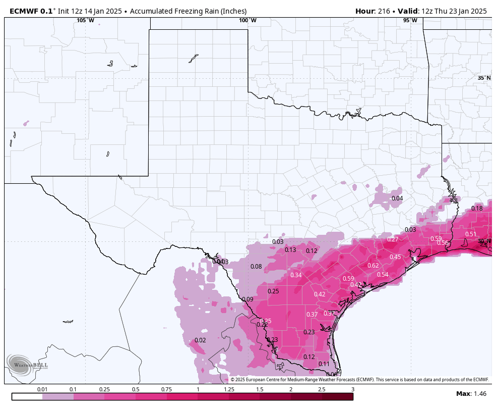
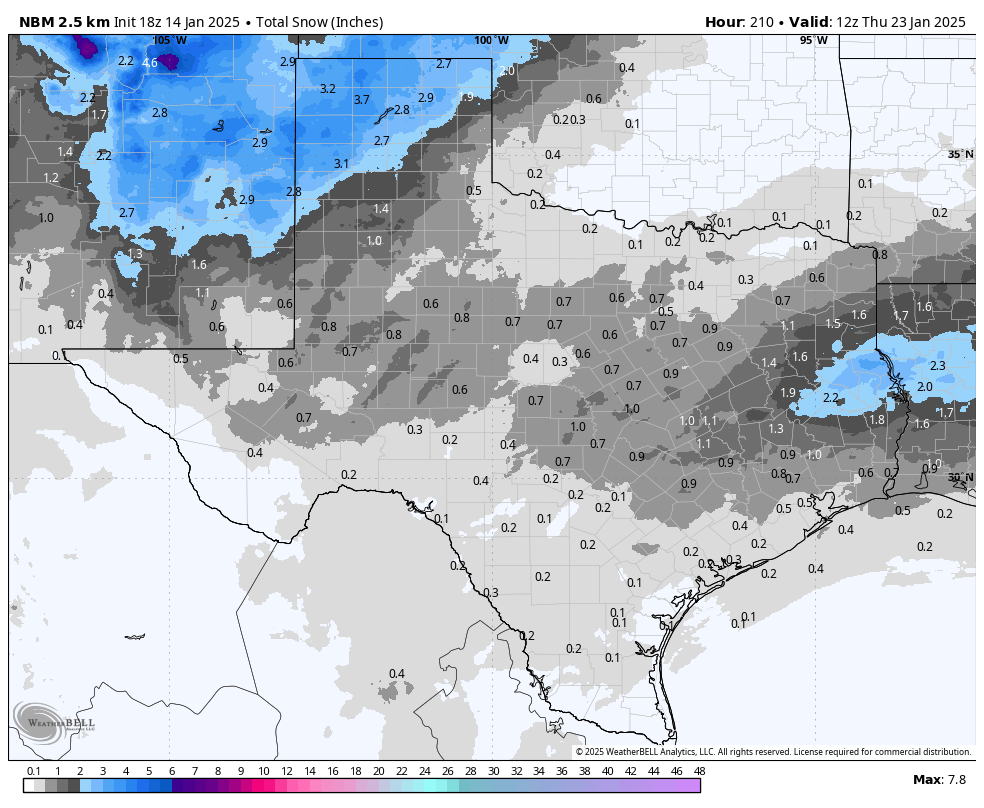
Below are all of the latest greatest graphics and model runs. Please remember that at this point, I would not trust any of the snow and ice forecasts yet, but the fact that all of the major models are all forecasting some kind of winter event, should be used for planning and prepping.
Mark

This Update is brought to you by Bahia Services and Rentals in Port O'Connor, TX https://www.facebook.com/BahiaServicesandRentals


The arctic front should arrive Saturday night.
Current snow forecast for Monday night through Wednesday. Take these with a grain of salt and a shot of Tequila, but it never hurts to prep and plan! Click on images to see them larger.


Current ice forecast for Monday night through Wednesday. Take these with a grain of salt and a shot of Tequila, but it never hurts to prep and plan! Click on images to see them larger.