A chance for rain in south Texas and the coastal plains.
1-13-25. 1:30pm. This update is brought to you by Dietz-McLean Optical. www.dmoptical.com
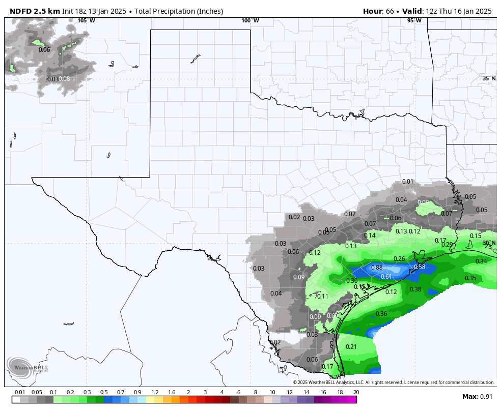
Just as it looked like this was going to be a “cruise control” week weather wise, today’s models are forecasting a weak, inverted trough to move into south Texas from Mexico on Tuesday night and Wednesday. While not drought busting totals, south Texas, the coast and coastal plains could see a quarter to a half an inch of rain by Thursday…some nice bonus rain! A few locations in the southern counties of south-central Texas may also see some rain.
As far as our upcoming arctic outbreak, fortunately, most of the models are tempering the temperatures a bit, with only the Canadian model forecasting a multi-day under freezing event. That doesn’t mean we won’t see cold weather; hard freezes are still in store and the models still have several days to change their minds!
Our prayers go out to southern California where they can’t seem to catch a break in the weather…current wind gusts are over 40mph in the mountains this morning.
Mark

This update is brought to you by Dietz-McLean Optical. www.dmoptical.com
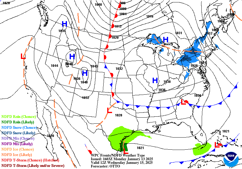
An inverted trough will give south Texas a chance for rain on Wednesday…a few locations in southern counties of south-central Texas may also see some rain.
How much rain these models think will fall from late Tuesday-early Thursday. Click on images to see them larger.


How far below normal these models are predicting for temperatures next week. Numbers shown are how many degrees below normal, not actual! Click on images to see them larger.


Our prayers go out to southern California where they can’t seem to catch a break in the weather…current wind gusts.
