Model madness continues!
5-2-24. 6:15pm This update is brought to you by Davy Ranch Supply in Yorktown, TX. davyranchsupply.com
Yet another strange weather day…It started out with hardly any rain overnight for the southern counties of south-central Texas, despite a Flood Watch being issued yesterday. Today, some unexplained, rogue small cells formed in and around Bexar and Comal counties, dropping over an inch of rain in a few lucky locations. Now, a dryline to our west is trying to spawn some thunderstorms this evening, but even the Storm Prediction Center isn’t sure whether to extend the current Severe Thunderstorm Watch further south.
So, for now, let’s just say that we will continue to see a chance for rain through Sunday, with Saturday night and Sunday looking the most promising as a disturbance and dying cool front bump up our storm odds a bit. If you don’t get rain by Sunday then “Forget About It”, through Thursday as a mini “Hell High” moves into south Texas from the Gulf on Monday. While we probably won’t see too many temperatures over the century mark in south-central Texas, our highs will certainly flirt with 100 while locations along the border may see highs of 105-110 degrees! Fortunately, a cool front should move through on Thursday night or Friday, sending our temperatures back to normal or slightly below normal for a couple of days, along with a chance for rain.
Mark

This update is brought to you by Davy Ranch Supply in Yorktown, TX. davyranchsupply.com
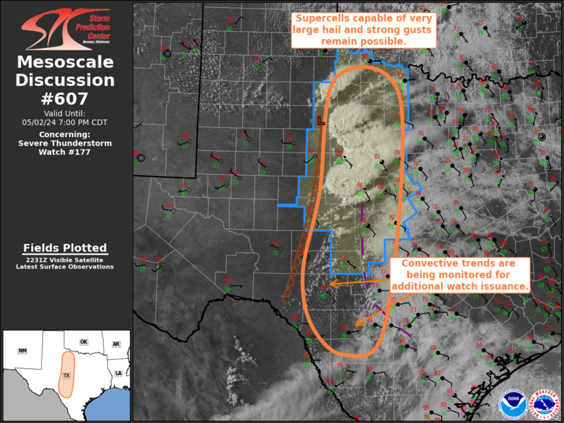
The Storm Prediction Center is watching this area of towering cumulus along the dryline this afternoon to see if they may extend the current Severe Thunderstorm Watch further south.

We are hoping to see an increase in thunderstorm activity on Saturday night and Sunday as a cool front washes out in south-central Texas.
Although the models have been misbehaving lately, they are the only tools we have to see what may or may not happen over the next few days. Here’s how much rain they think will fall between today and Sunday. Click on images to see them larger.


