Model Madness!
6-4-24. 4:30pm. This Update is brought to you by Dietz-McLean Optical. www.dmoptical.com
Model madness!
I'm going over the latest model runs and I am officially confused! While the NWS and their model is not even mentioning rain this afternoon, the GFS, Euro and NAM models think some thunderstorms will develop around sunset in and around Austin and San Antonio, then drift SE. I've included the models for tonight below. We also have another slight chance for storms on Wednesday evening. None of these will be big rainmakers, but if they materialize a few rain lottery winners could see 1/2 and inch or more. Personally, I will be surprised if storms form this evening, but with the extreme heat and humidity, it is possible.
Speaking of rain lottery winners, Laredo did see a dying storm last night from Mexico. They reported 0.20 inches of rain. Premont also had a storm and recorded 0.10 inch of rain.
The one thing that is not in doubt, is the heat! Heat indexes are in the 110's this afternoon and will continue to be hellish for the next several days. Believe it or not, a rare June cool front may push into our area on Monday, knocking down our highs into the 80's for Tuesday and giving us a good chance for rain...stay tuned!
Mark

This Update is brought to you by Dietz-McLean Optical. www.dmoptical.com
4pm heat index and current warnings and advisories. Click on images to see them larger.


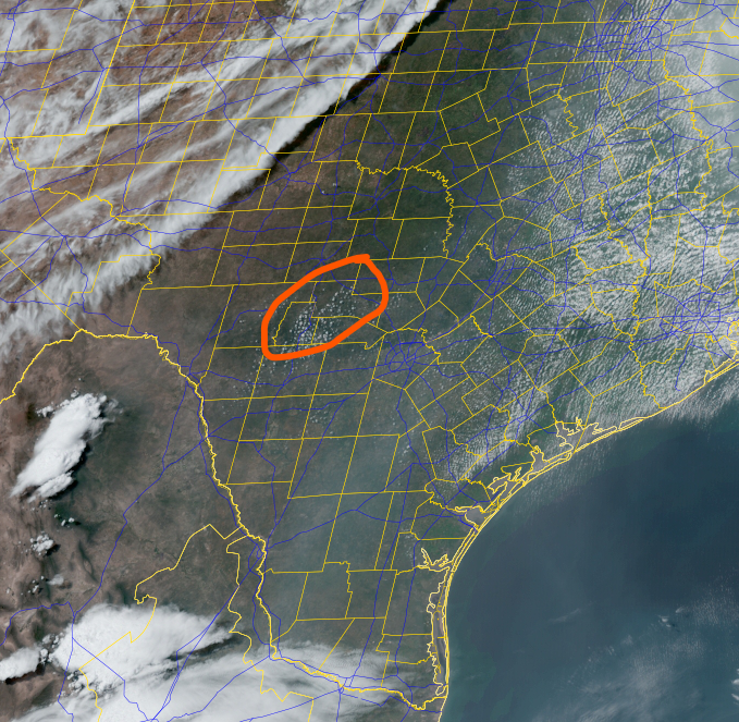
At 4pm the satellite is showing some towering cumulus clouds over the Hill Country...could storms form later this evening? There is a frontal boundary to the NW. This front is not expected to move any further south.
Here are the models that think storms could form this evening. Click on the images to see them larger.


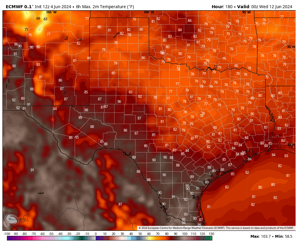
Here's what the latest Euro model is forecasting for high temperatures on Tuesday!