A cold and dreary day…
12-7-24. 2:45pm. This Update is brought to you by 5E Trailers in Marion. They’re here to help you find the perfect trailer at the best price! https://www.5etrailers.com/
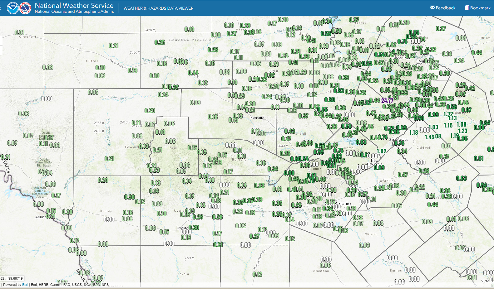
Once again, the models blew it for south-central Texas, but I don’t think anyone is complaining! My weather station in NW Bexar County recorded 1/2 an inch of rain and parts of Comal and Hays counties saw totals of over an inch! Unfortunately, the models did get it right for south Texas, where most locations received less than a tenth of an inch.
There are still a few showers out there this afternoon, but the rain is starting to wind down and we will be mainly left with just clouds tonight and tomorrow. With the clouds and rain today, temperatures have struggled to reach the mid 40’s for most of south-central Texas and 50’s for south Texas.
We will warm into the 60’s on Sunday, then the upper 70’s and 80’s on Monday ahead of our coldest air of the season, expecting to breeze through early Tuesday. I’d expect some freeze watches and warnings to be issued for Wednesday morning, when there will be a lot of lower 30’s and some upper 20’s for lows!
How much rain fell at your place and where?
Mark

This Update is brought to you by 5E Trailers in Marion. They’re here to help you find the perfect trailer at the best price! https://www.5etrailers.com/

2:45pm radar update.

Austin's skyline is gone!

Current temperatures in south-central Texas are colder than where I am at 8000 feet in SW Colorado right now!
24hr rainfall totals from the NWS and Weather Underground. Click on images to see them larger.


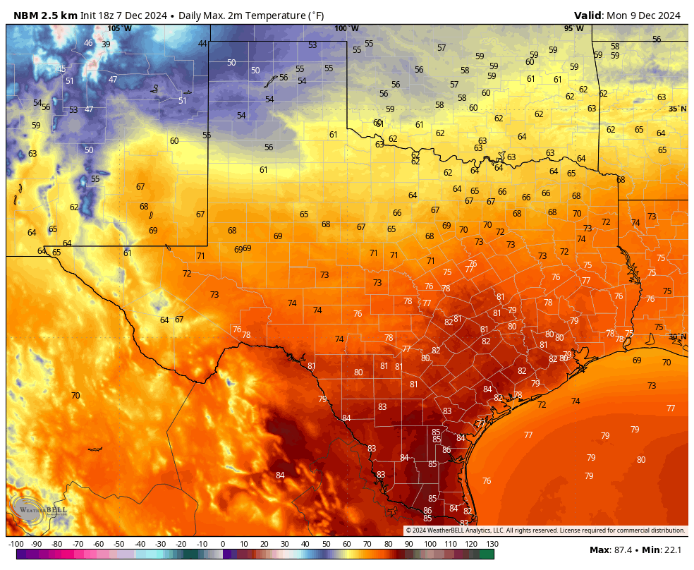
We could see record highs on Monday!

Our strong front arrives early Tuesday morning.

Forecast lows on Wednesday.

Forecast lows on Thursday.