Bonus rain for a few of you!
8-5-24. 2:15pm. This Update is brought to you by Dietz-McLean Optical. www.dmoptical.com
So great to see that our upper-level low, which is moving west into Mexico, delivered some surprisingly decent rain to some of our counties to the west and SW of San Antonio yesterday and last evening! Some of the most impressive rain totals were 2.30 inches near Bandera, 1.60 inches near Cuero, 2.56 inches in Austin, 1.30 inches near Knippa, 1.15 inches in Hondo and 1.47 inches near Llano.
Here is a link to the 24hr rain totals in South-Central Texas.:
https://mesonet.agron.iastate.edu/wx/afos/p.php...
Below are graphics for the past 48hrs.
Looking down the proverbial weather line, high pressure will rule for at least another week, with overall temperatures running 3-6 degrees above normal. A couple of models think that the tropical wave in the Carribean might turn into a tropical something and move into the Gulf. The NHC gives it a 30% chance for becoming a storm over the next week. Those same models that predict it going into the Gulf, also predict it going into far eastern Texas or Louisiana. Way too soon to know what will happen at this point, but worth watching! Prayers for those in the SE dealing with Debby...her rainfall totals are going to be disastrous for many.
If you got some rain over the past 48hrs, please share how much and your location!
Mark

This Update is brought to you by Dietz-McLean Optical. www.dmoptical.com

Satellite mid-level water vapor imagery of our exiting upper-level low and Tropical Storm Debby.
Click on images to see them larger. 48hr rainfall totals from the NWS and COCORAHS volunteers.


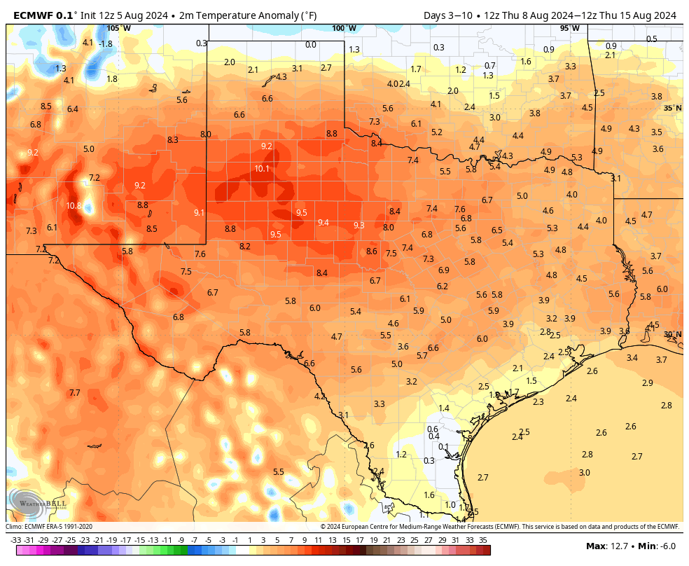
Overall temperatures this week and next will be averaging above normal.

Watching to see what this tropical low does!
Click on images to see them larger. How much rain these models predict between today and the 15th.


