Our rainmaker is about 24hrs away!
3-25-25. 3:30pm. This Update is brought to you by Sedley's Grass Fed Beef. Sedley's Grass Fed Beef is a family-owned farm to table beef cattle operation located in western Gonzales County roughly 50 miles east of San Antonio and 70 miles south of Austin. www.sedleysgrassfedbeef.com
After some fog this morning, we are warming up quickly this afternoon, with temperatures in the 80's and 90's.
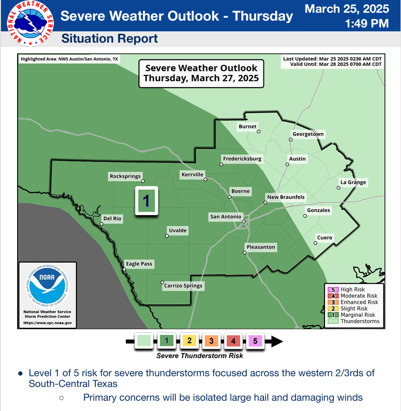
A couple of days ago I mentioned that the Storm Prediction Center was not including our area for any potential severe storms when our upper-level trough moves through this week. While the latest update from them keeps severe storms at a relatively low threat, we are now included for potentially severe storms starting tomorrow afternoon, mainly along the border as the first disturbance moves in from Mexico.
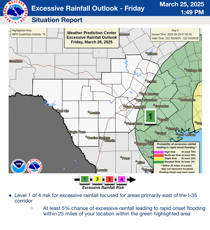
Lots of surface moisture will be flowing in from the Gulf and in the upper levels of the atmosphere from the Pacific as a series of disturbances ahead of an upper-level trough give us a great chance for not only rain, but the potential for floods in some areas. The NWS in Corpus has issued a Flood Watch from late Wednesday through Friday for all of south Texas...graphics below.
While the latest heavy rainfall impact of the low has shifted slightly south of HWY 90 and I-10, I think most locations to the north will still see at least 1-2 inches of rain from this system and the track of the trough could change yet again more northward. I caution everyone not to get too excited when looking at the models below...they are moving targets and will continue to be so until this rainmaker moves further east into Mexico tomorrow and there is better data. Right now, it's still over the Pacific, to the west of Baja.
Mark
This Update is brought to you by Sedley's Grass Fed Beef. Sedley's Grass Fed Beef is a family-owned farm to table beef cattle operation located in western Gonzales County roughly 50 miles east of San Antonio and 70 miles south of Austin. www.sedleysgrassfedbeef.com
3pm temperatures.
...FLOOD WATCH IN EFFECT FROM WEDNESDAY AFTERNOON THROUGH FRIDAY
MORNING...
* WHAT...Numerous flash floods likely with significant events
possible.
* WHERE...For all of South Texas
* WHEN...From Wednesday afternoon through Friday morning.
* IMPACTS...Excessive runoff may result in flooding of rivers,
creeks, streams, and other low-lying and flood-prone locations.
Creeks and streams may rise out of their banks. Flooding may occur
in poor drainage and urban areas. Low-water crossings may be
flooded.
The latest NWS update on this event. Click on images to see them larger.
How much rain the latest models are forecasting from Wednesday through Friday. Click on images to see them larger.


