A step in the right direction!
8-13-24. 4:30pm. This Update is brought to you by Davy Ranch Supply in Yorktown, TX. davyranchsupply.com
It's starting to happen...we have storms to the east and temperatures are not as brutal as they have been! Over the next few days, we will see a continued lowering of our high temperatures and in increase in rain chances. Sorry, I'm still not seeing a cool front on the horizon.
Here's what the NWS is saying in their afternoon update: "The upper-level ridge is forecast to shift north Saturday night into
Sunday. Beneath the ridge, an upper-level low over the northeast
Gulf slides west into the northwest Gulf and Texas Coastal Plains
Sunday afternoon and evening, into south-central or south Texas on Monday, and near the Rio Grande on Tuesday. Isolated to scattered showers and thunderstorms are forecast across the Coastal Plains Sunday afternoon, farther inland to near the I-35 corridor Monday afternoon, and across much of south-central Texas on Tuesday.
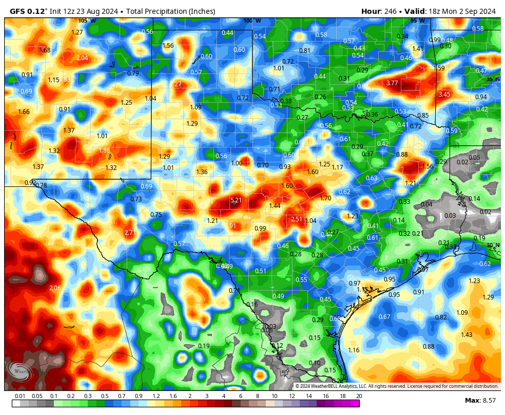
The Canadian model finally gave up on the upper-level low turning into a tropical something, but it's still forecasting some decent rain totals for next week for the coast and coastal plains. Most of the models are forecasting rain next week but placing the higher totals in different areas! Hopefully we will have better model consensus in a few days.
Hope one of these PM Poppers finds your backyard this afternoon!
Mark

This Update is brought to you by Davy Ranch Supply in Yorktown, TX. davyranchsupply.com.

4:20pm radar imagery.
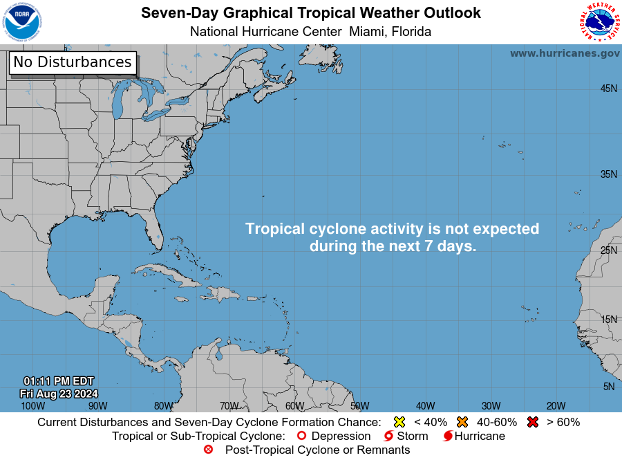
No help from the tropics!

Next week's highs are still hot, but much better than this week!
Click on images to see them larger. How much rain these models think will fall between today and 9-2.