Some easing of the heat for next week!
8-20-24. 6pm. This Update is brought to you by Bahia Services and Rentals in Port O'Connor, TX https://www.facebook.com/BahiaServicesandRentals
After being beaten up by the Hell High this week, it's great to see some more reasonable temperatures (mid-upper 90's) forecast for next week, along with a chance for rain. The much-advertised inverted trough will form in the Gulf and move very slowly westward next week, increasing rain odds for the coast and coastal plains starting this weekend, then the rest of south and south-central Texas next week. There is a tiny chance of some storms forming on Thursday, thanks to a stationary cool front over east Texas.
I'm still scratching my head, trying to understand why we aren't seeing more activity in the Atlantic and Gulf. Both bodies of water are running above average, and logic would say the odds of more storms forming would be great right now.
Below are today's scorching high temps along with the latest models, etc.
Tomorrow's temperatures should be the worst of this heat wave...hopefully we will see a slow downward trend in our high temperatures starting on Thursday.
Mark

This Update is brought to you by Bahia Services and Rentals in Port O'Connor, TX https://www.facebook.com/BahiaServicesandRentals

Our high temperatures as of 5pm.
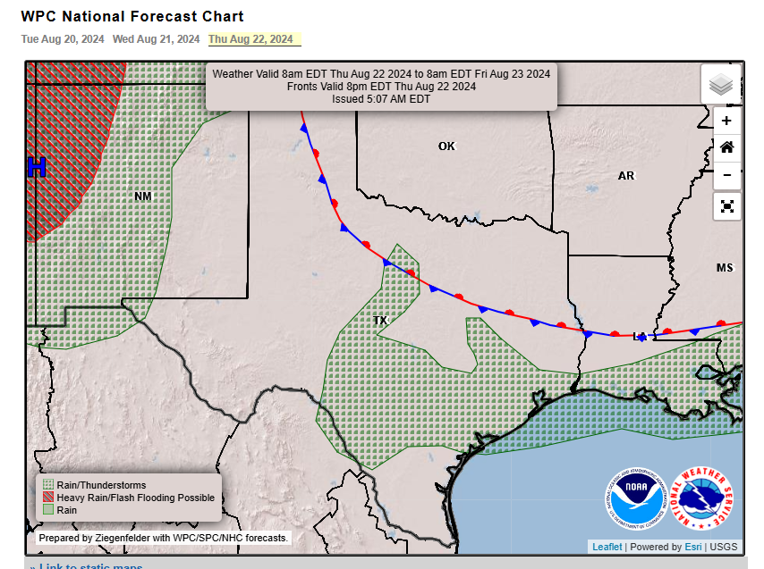
A stationary front in NE Texas may generate a few scattered storms on Thursday afternoon.

The latest 7-day NWS rainfall forecast.

Ocean temps are running above normal right now...odd that there are no storms brewing.

Forecast high temperatures for Wednesday.

Forecast high temperatures for Thursday.
Click on images to see them larger. Forecast rainfall totals through the 30th.


