It’s Showtime!
11-17-24. 3:45pm. This Update is brought to you by Jack Garrett and Phase II Fertilizer. Phase II, Inc. was founded in 1994 with a mission to Help Family Farmers & Ranchers Thrive. You can reach Jack at 361-275-4841.
At post time, our low pressure is in Mexico, to the south of Arizona. As it moves NE, it will be kicking off some potentially severe storms over north and central Texas and possibly as far south as the Texas Hill Country tonight and tomorrow morning. As I have mentioned several times this week, the best odds for rain will be along and north of a line from Del Rio to San Antonio to Houston. I’m hoping the coastal plains also gets in on the rain as well, but your odds are certainly less than south-central Texas. Threats from the severe storms will be the usual, hail, high winds and a few tornadoes. As always, tune to your local NOAA radio station or make sure you have warnings turned on for your favorite weather apps.
The wimpy front moves through tomorrow afternoon, dropping our temps back to close to normal, with lows in the 40’s and 50’s and highs in the 70’s on Tuesday. A much stronger, but dry front moves through on Tuesday night and by Wednesday morning we will actually see our first wind chill readings in the 30’s of the season with winds gusting to 25mph. Lows will drop into the 30’s and 40’s on Thursday and Friday with highs in the upper 60’s to low 70’s! There could be a few low spots in the Hill Country that flirt with a freeze on Thursday morning.
Things dry out in the short and long-term and temperatures will ease back up to “above normal” by next week. As of today, it does look like a season front will arrive just before Thanksgiving so we don’t have to run our AC units!
Mark

This Update is brought to you by Jack Garrett and Phase II Fertilizer. Phase II, Inc. was founded in 1994 with a mission to Help Family Farmers & Ranchers Thrive. You can reach Jack at 361-275-4841.

Our wimpy front is currently stationary out in west Texas.

The low pressure that will ignite our rain chances is currently south of AZ and moving NE.
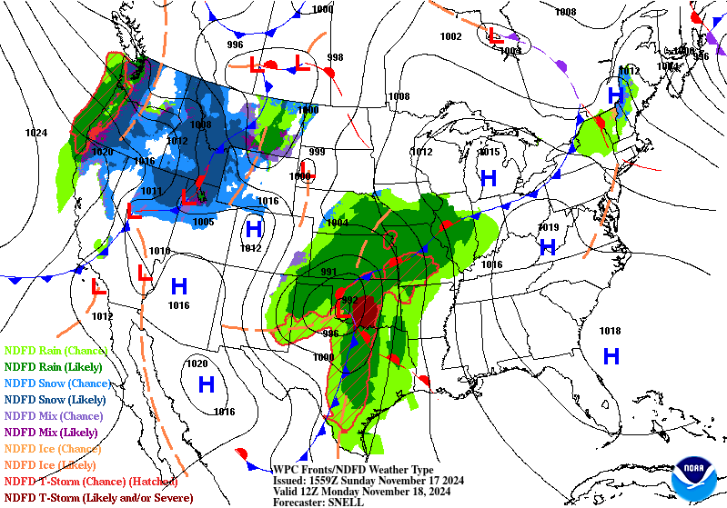
Our frontal passage and best rain odds will be tomorrow morning.

Where the best odds for severe weather will be this afternoon and evening.
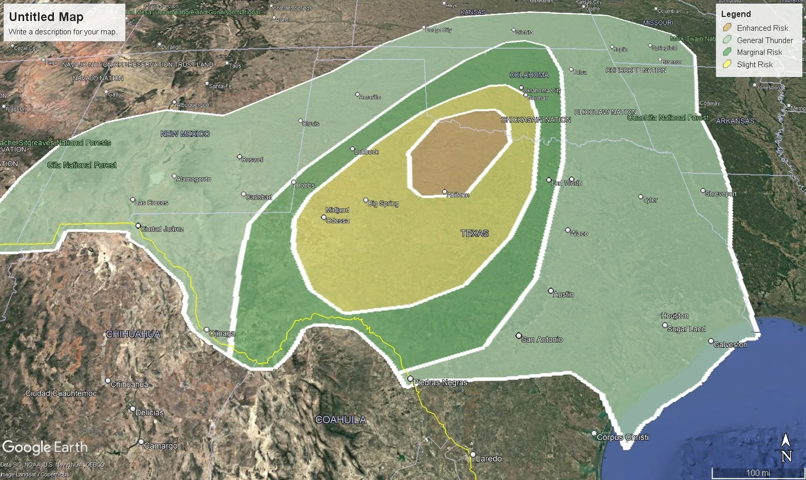
Where the best odds for severe weather will be this afternoon and evening.


Where the best odds for severe weather will be tomorrow.
How much rain these models think will fall over the next 24hrs. Click on images to see them larger.


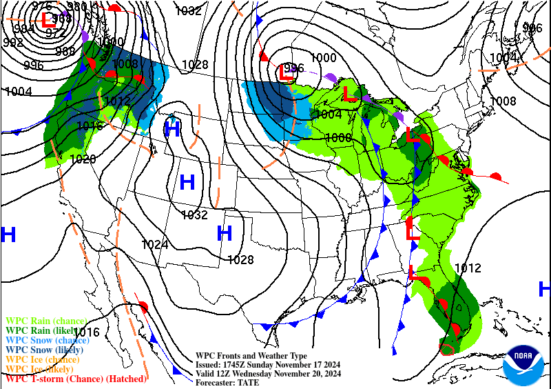
The strongest front of the season arrives Tuesday night.

Forecast wind chills on Wednesday morning.

Forecast lows for Thursday morning.