The weather gods did not get the memo!
3-16-24 10am. This update is brought to you by Bahia Services and Rentals in Port O'Connor, TX https://www.facebook.com/BahiaServicesandRentals
Yesterday was a perfect case of the weather gods not reading the forecast! Not only were the professionals at the Storm Prediction Center fooled, but all of the major models as well. The cool front was supposed to have gone stationary right over San Antonio, giving most of south-central Texas a great chance for rain and severe storms. Instead, the front drifted almost to the coast, leaving most of our area high and dry. On a positive note, Laredo and other parts of deep south Texas did see some rain.
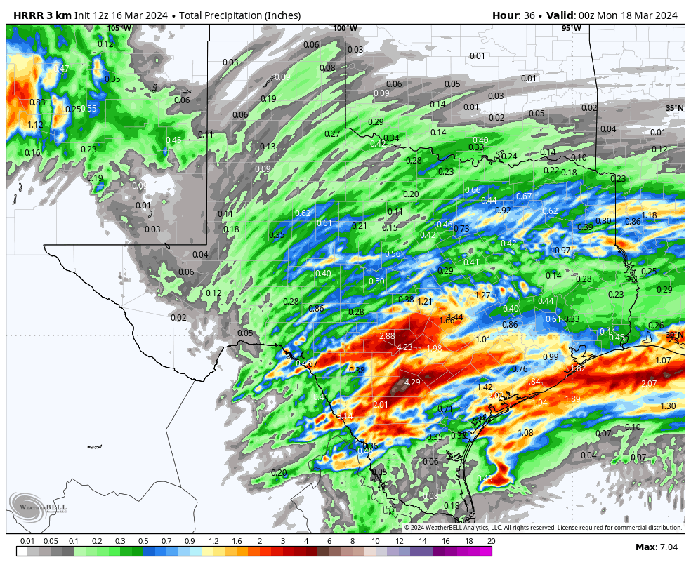
As for today, the front will move a few miles back to the north during the day, and along with lots of mid and high-level moisture from the SW, disturbances from the west (from the cut-off low) and a surface low near the coast, give us a great chance for rain over the next 36 hours. Late on Sunday, another cool front will move through, drying us out for a few days until the cut-off low finally gets absorbed into a trough that will give us another chance for rain on Thursday and Friday of next week.
Below are all of the details, including the latest radar imagery as of 9:45 am. Some of you south of San Antonio are getting some heavy rain as of post time. Movement is NE.
Mark
3-16-24 10am. This update is brought to you by Bahia Services and Rentals in Port O'Connor, TX https://www.facebook.com/BahiaServicesandRentals
Today’s surface map and where rain will fall.
The cut-off low to our west will continue to bring in moisture from the SW and send disturbances our direction over the next 36 hours.
9:45am radar imagery. Movement is NE.
The latest short-range model runs for rainfall through Sunday.


