The latest on our “tropical something”…
6-14-24. 1pm. This Tropical Update is brought to you by 5E Trailers in Marion. They’re here to help you find the perfect trailer at the best price! https://www.5etrailers.com/
I try to learn something new at least once or twice a year! Today's new term for me is Central American Gyre! From Wikipedia, "The Central American gyre (CAG) is a broad and seasonal area of low pressure that occurs over the eastern Pacific Ocean and western Caribbean Sea."
And why, do you ask that I bring this up? Here is the latest tropical discussion from the NHC: "A Central American Gyre is forecast to develop over the next couple of days. Environmental conditions
appear conducive for a tropical cyclone to develop from this broad area of low pressure, and a tropical depression could form over the southwestern Gulf during the early or middle part of next
week. Active convection, along with increasing winds and building seas are expected with this system."
As of this post time, we are looking at a 50% chance that a "tropical something" will form in the Gulf over the next week. As an aside, I have been using the phrase "tropical something" over a decade now and I noticed a Facebook page in Laredo used it yesterday on their post...hmm.
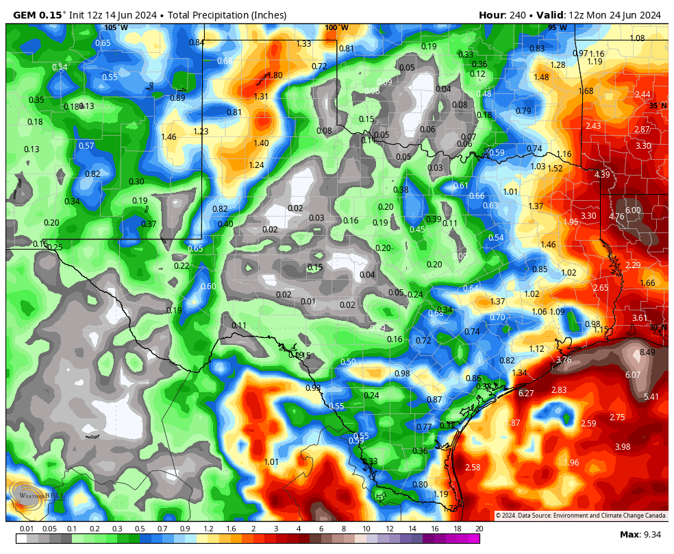
Anyhow, since we still don't have a circulation yet, take all of the models with the usual grain of salt and shot of tequila. I'm still feeling optimistic that south Texas and the coastal plains will get some beneficial rain from this system...for south-central Texas it will all depend on how far north this storm goes before moving inland.
Mark

This Tropical Update is brought to you by 5E Trailers in Marion. They’re here to help you find the perfect trailer at the best price! https://www.5etrailers.com/

Click on images to see them larger. How much rain these models think will fall from next week’s “tropical something”!