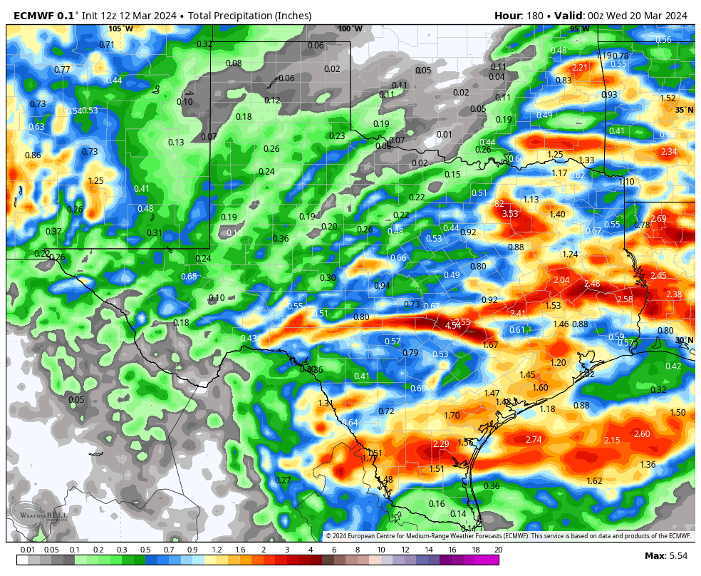
The cut-off low will hang around longer than originally forecast…that’s a good thing!
3-12-24 6:45pm. This update is brought to you by Dietz-McLean Optical. www.dmoptical.com
Thanks to the cut-off low that will form in southern California on Thursday, deciding to camp out for at least five days to our west, our rain odds will linger into next week. The first disturbance from this low will arrive on Thursday afternoon, but as of now, most of the rain and storms will stay in north and east Texas. On Friday, a slow-moving front will drift southward during the day, giving south-central and south Texas a decent chance for storms and rain. During the weekend, the low will drift slowly east, sending more disturbances and rain our direction. Moisture from the Pacific will stream in from the SW from Thursday through Tuesday.
Temperatures will be cool, with lows in the 50’s and highs in the 60’s under cloudy skies. As of this post time, it looks like the low will finally move NE into the plains next week., ending our rain chances by Wednesday. With the slowing of the low, almost all of the models are now forecasting a decent rain event…let’s hope this continues!
Mark
This update is brought to you by Dietz-McLean Optical. www.dmoptical.com
The cut-off low is still forecast to be in southern Arizona and far west New Mexico on Monday morning. This keeps our rain window open through at least Tuesday. The low will eventually move NE into the plains next week. Moisture from the Pacific will stream in from the SW from Thursday through Tuesday.
A slow-moving front will give us a good chance for rain on Friday.
Below are the latest greatest model runs for total rainfall from Thursday through Tuesday of next week.


