Let’s talk about cut-off lows!
3-13-24 3pm. This update is brought to you by Bahia Services and Rentals in Port O'Connor, TX https://www.facebook.com/BahiaServicesandRentals
From Wikipedia: A cut-off low (or cutoff low), sometimes referred to as the weatherman's woe, is defined by the National Weather Service as "a closed upper-level low which has become completely displaced (cut off) from basic westerly current, and moves independently of that current." Cut-off lows form in mid-latitudes (usually in the subtropics or between 20° and 45°) and can remain nearly stationary for days.[2]
The cut-off low that will be forming in southern California tomorrow will certainly live up to the reputation as the “weatherman’s woe” as it spins around the west for nearly a week before drifting into the plains late next week. At least that is the latest forecast, as of today! This low will not only impact our weather, but weather throughout the SW, dropping lots of rain in the lower elevations and lots of snow over the mountains.
For us, look for rain chances to start as early as tomorrow, but most of the activity will stay to our NE, including severe storms. On Friday, a slow-moving front will give us a very good chance for rain as it moves through Texas. Tropical moisture overriding the cool surface air from the SW (Pacific moisture-thank you El Niño!).
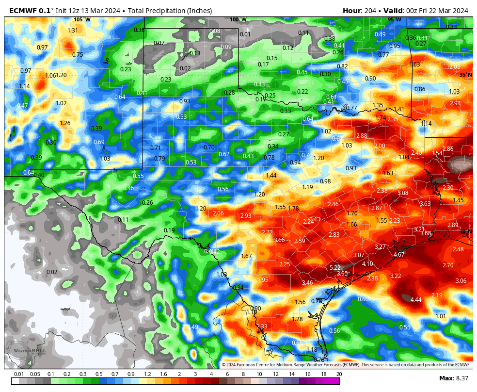
Thanks to the cut-off low staying to our west, disturbances from the low will move through our region through the weekend and into next week, giving us daily chances for rain and storms. At this point, it looks like we could see a chance for rain through at least Thursday of next week. There will be some breaks in the action, but looking over the latest model runs, everyone should see a decent soaking over the next week! The best odds for rain will be from Friday-Sunday.
Mark
This update is brought to you by Bahia Services and Rentals in Port O'Connor, TX https://www.facebook.com/BahiaServicesandRentals
The cut-off low will form in southern California tomorrow.
The latest GFS model run predicts the cut-off low will finally move into the Panhandle by next Thursday.
Tomorrow’s severe weather will for the most part, stay to our NE.
Our next cool front will take its time moving southward on Friday. This increases our chances of seeing higher rain totals.
Below are the latest model runs for 8-day rainfall totals.


