Still searching for that real cold front!
11-11-24. 1:15pm. This Update is brought to you by 5E Trailers in Marion. They’re here to help you find the perfect trailer at the best price! https://www.5etrailers.com/
Thanks to all of our veterans who have protected us through the years and kept our country alive and prospering. Pictured is my dad around 1947 when he was part of the early Air Force, stationed at McChord Field near Tacoma Washington. Quite fittingly, he was a radar operator!
Above normal temperatures through Wednesday, ahead of our next wimpy, dry front. Thursday and Friday will be nice, with lows in the 40’s and 50’s and highs in the 70’s…which are actually what our temperatures are supposed to be this time of the year!
I continue to feel bullish on a strong front arriving next week, but unfortunately, not so bullish on our rain odds. Here is the latest on next week’s strong front, from our SA-Austin NWS:
"First, a pacific cold front with a low chance for rain Monday evening into early Tuesday morning, followed by what could be the strongest front of the Fall in the Tuesday/Wednesday
time frame next week (Polar Front). For now, we will continue to
monitor how ensemble guidance looks over the coming days, but it does
give some glimmer of hope that ensemble guidance as at least in good
agreement on a strong front in the 8-9 day time frame."
Below are the latest CPC outlooks plus how much rain the various models think will fall next week.
Mark

This Update is brought to you by 5E Trailers in Marion. They’re here to help you find the perfect trailer at the best price! https://www.5etrailers.com/
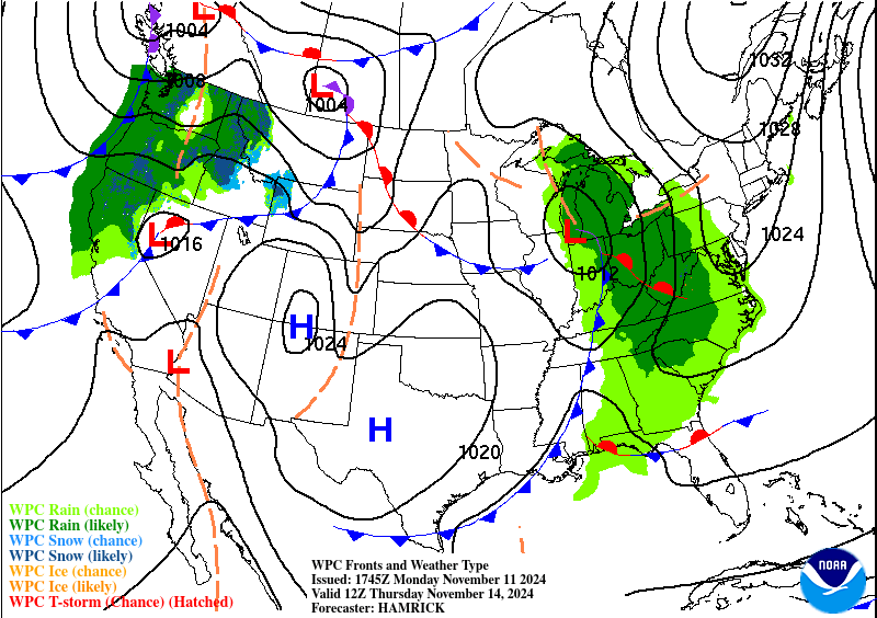
Our next wimpy, dry front, arrives late on Wednesday.
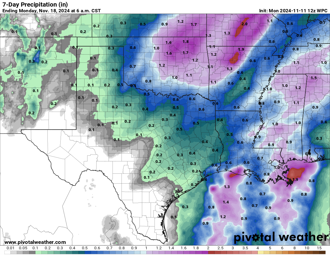
The latest NWS 7day rainfall forecast.

Next week's front could actually drop our temperatures below normal for a few days!
How much rain the latest models think will fall next week. Click on images to see them larger.


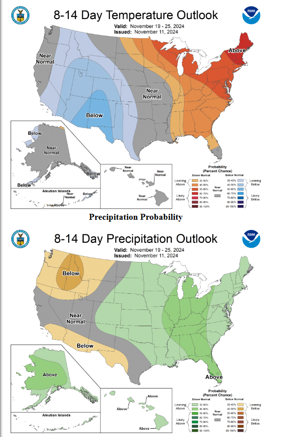
The odds for below normal temperatures are nudging closer to us!