Winter is coming!
1-20-25. 2pm. This Update is brought to you by 5E Trailers in Marion. They’re here to help you find the perfect trailer at the best price! https://www.5etrailers.com/
It’s showtime! An upper-level disturbance moving in from the west, along with a coastal low, will give us a wide range of precipitation tonight and tomorrow. With dry air aloft, it will take some time before actual precipitation reaches the ground, but by early tomorrow morning we should start seeing anything from snow, sleet, freezing rain and rain. If you can avoid driving anywhere tomorrow, I would recommend not doing so! Fortunately, this will be a short-lived event, with temperatures rising above freezing in the afternoon and by Wednesday, most of us should see highs in the 40’s and 50’s. While we see a rebound in our highs, tomorrow’s lows will be in the 20’s and even colder on Wednesday morning with many locations ending up in the teens and lower 20’s. By Friday, this will all just be a memory, with highs in the 60’s and 70’s by this weekend!
Stay safe and I hope none of you lose power tomorrow!
Mark

This Update is brought to you by 5E Trailers in Marion. They’re here to help you find the perfect trailer at the best price! https://www.5etrailers.com/

Tomorrow’s surface map features a wide variety of precipitation!
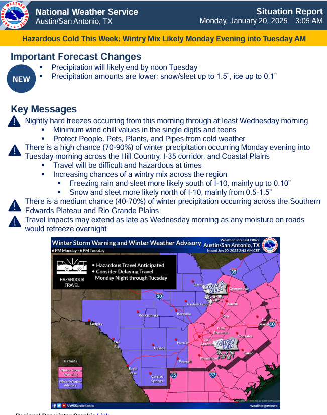
The latest special weather statements from the NWS in Corpus Christi for south Texas. Click on images to see them larger.


The latest special weather statements from the NWS in SA-Austin for south-central Texas. Click on images to see them larger.


Forecast lows for Tuesday.
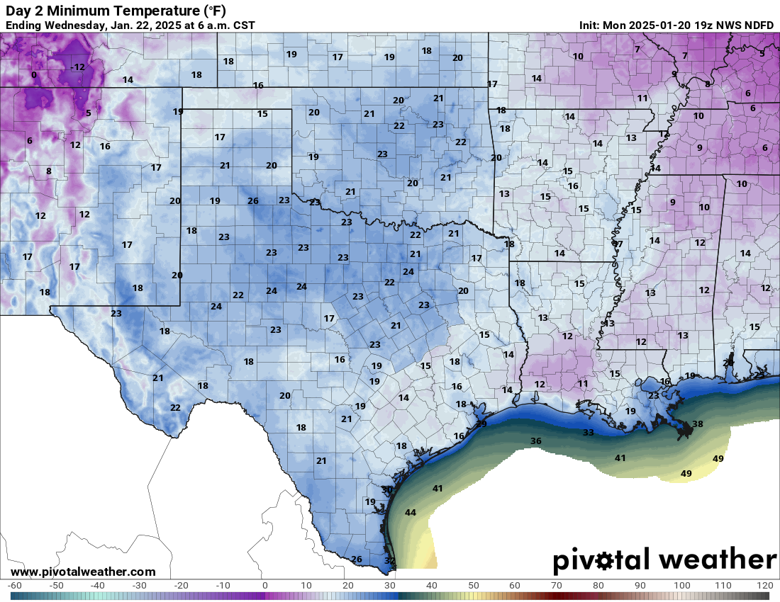
Forecast lows for Wednesday.
How much snow these models think will fall between tonight and tomorrow. Click on images to see them larger.


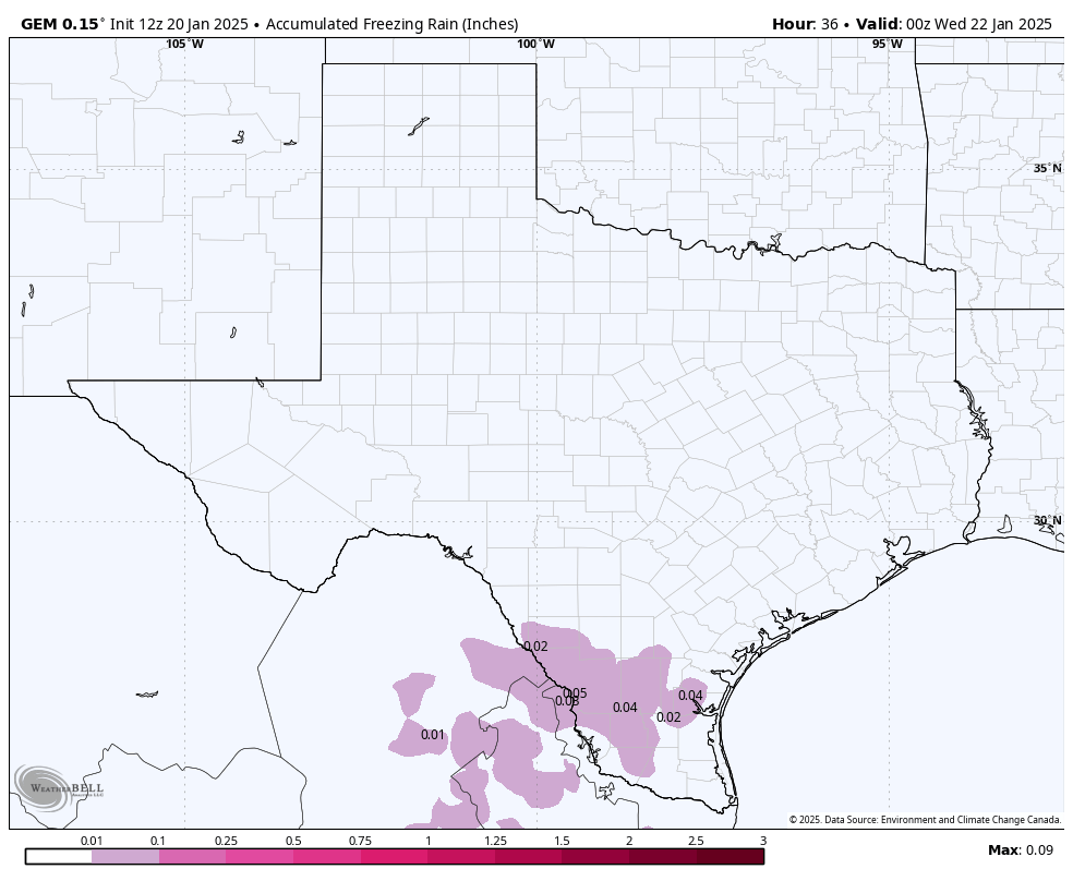
How much ice these models think will fall between tonight and tomorrow. Click on images to see them larger.


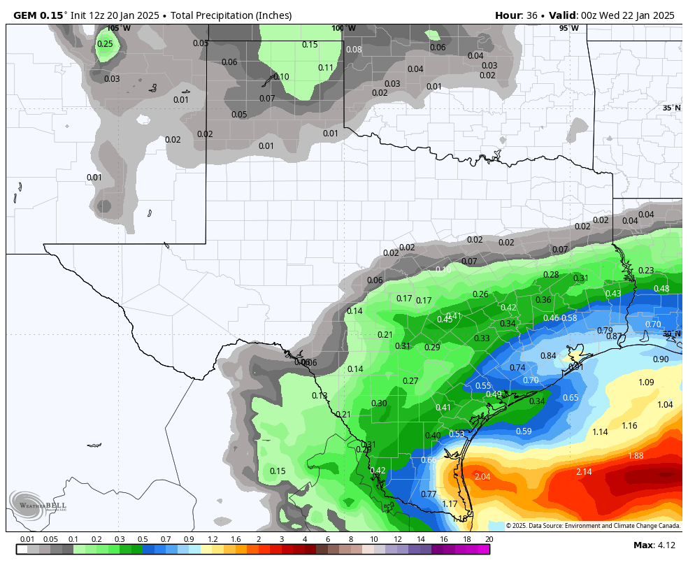
How much precipitation these models think will fall between tonight and tomorrow. Click on images to see them larger.