A chance for rain, then a shot of some cold air!
11-15-24. 4:30pm. This update is brought to you by Bahia Services and Rentals in Port O'Connor, TX https://www.facebook.com/BahiaServicesandRentals
A pleasant, but warm, weekend ahead with lows in the 50’s and 60’s and highs in the 80’s. We won’t see any rain in the forecast until Sunday afternoon and evening.
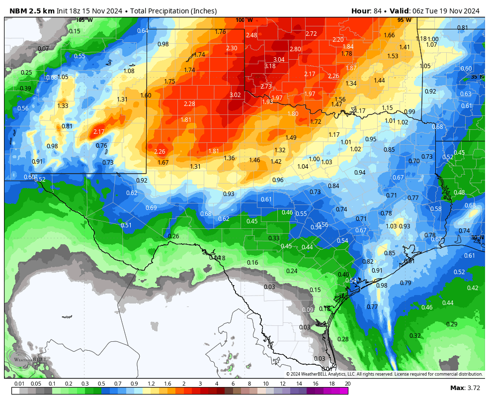
A strong low pressure will develop off of Baja on Saturday, then trek NE over the weekend and early next week into New Mexico, the Panhandle, then the plains. Unfortunately, we will be on the southern edge of the energy from this system, so most of the rain will stay in central and north Texas. Even so, there is still a decent chance for rain north of a Del Rio to San Antonio to Houston line. In fact, most models are forecasting a tenth to a half an inch of rain on Sunday night, with the possibility that some storms could go severe. Some cooler air will funnel in from this Pacific front on Monday.
On Wednesday, another front arrives with the coldest air that we have seen this season. By Thursday morning there could be readings in the mid 30’s in the Hill Country and 40’s for the rest of our area. Highs for Wednesday-Sunday will be in the 60’s and low 70s.
Have a great Friday night!
Mark

This update is brought to you by Bahia Services and Rentals in Port O'Connor, TX https://www.facebook.com/BahiaServicesandRentals

A strong low pressure will develop off of Baja, then trek NE over the weekend and early next week. Unfortunately, we will be on the southern edge of the energy from this system.

Our best odds for rain will be Sunday night as a Pacific cool front moves through our area.

The best odds for severe weather will be on Sunday night and to our NW.
How much rain the latest models think will fall between Sunday and Monday of next week. Click on images to see them larger.


Forecast lows for Thursday morning of next week!