No fooling…a chance for severe storms!
4-1-24. 9:45am. This severe storm update is brought to you by Bahia Services and Rentals in Port O'Connor, TX https://www.facebook.com/BahiaServicesandRentals
While I enjoy April 1st pranks and jokes, I don’t do them if there is a chance for severe weather! While the overall coverage and odds remain fairly low, there is a chance for severe storms forming along the front tonight. If one does end up over your home, look for a chance for hail, high winds and even a tornado. As I mentioned yesterday, the best odds will stay to our NE, but overnight the Storm Prediction Center has dropped the yellow zone (slight chance) down to San Antonio. The latest future radar model from the HRRR predicts a broken line of storms to form in the Hill Country around 6pm, then move SE. That would put the storms pushing through the I-35 corridor around 9pm.
Before the storms move through, look for the potential for record highs to be broken in San Antonio, Del Rio and Laredo. Highs along the Rio Grande should exceed 100 degrees this afternoon.
As always, please tune to your NOAA radio or emergency apps for warnings for your area.
Mark

This severe storm update is brought to you by Bahia Services and Rentals in Port O'Connor, TX https://www.facebook.com/BahiaServicesandRentals
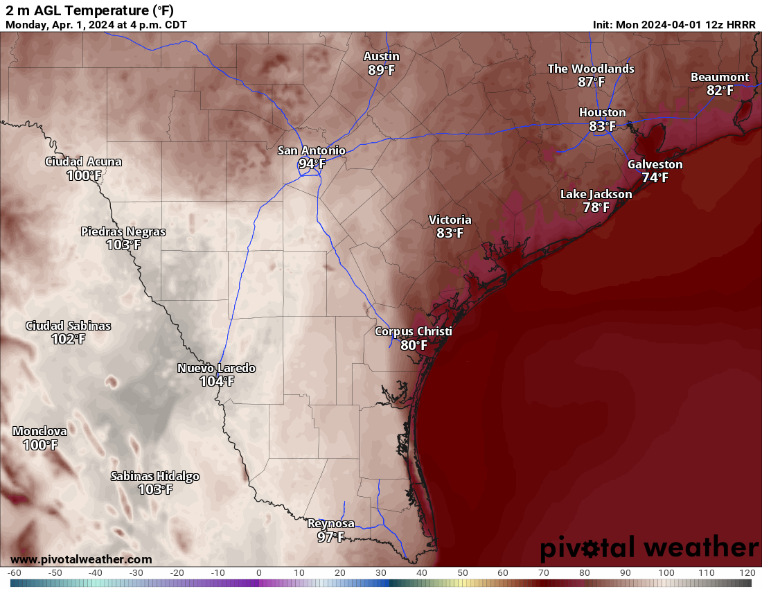
Forecast highs for today.


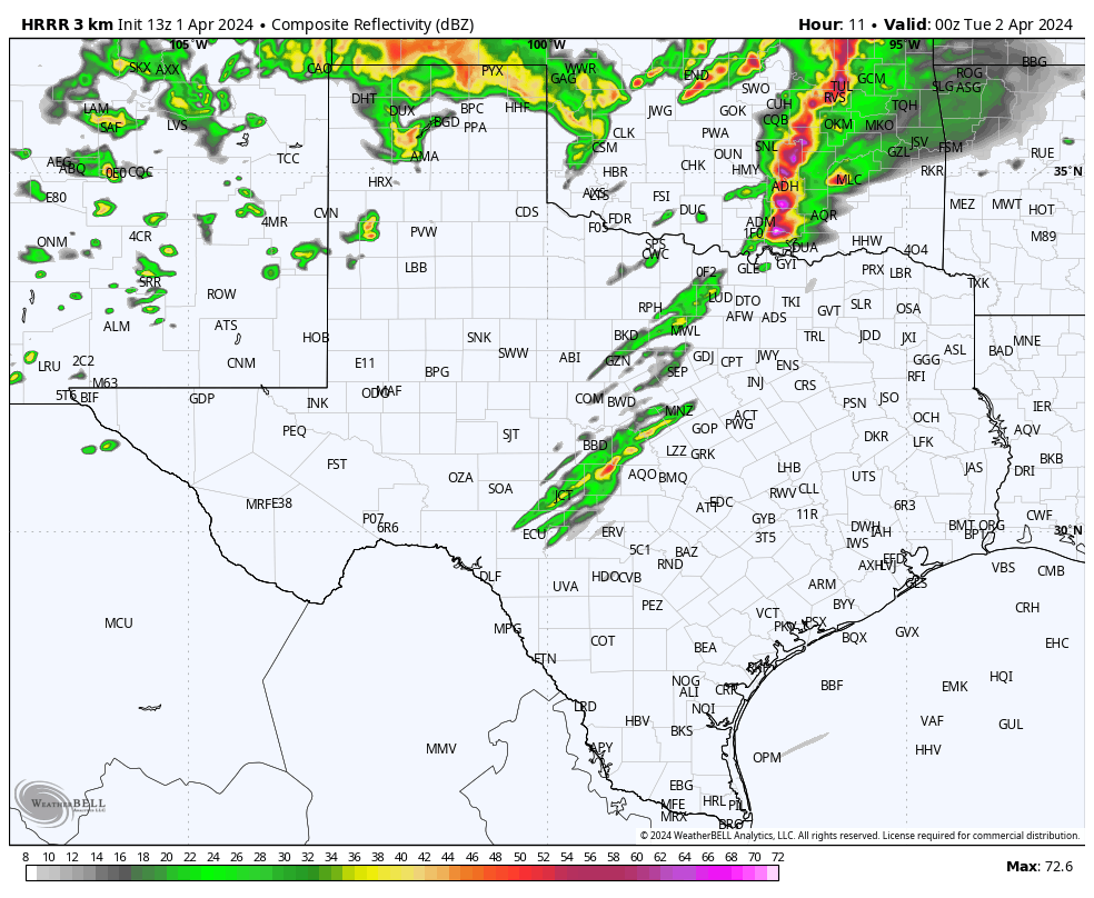
HRRR model radar forecast for 6pm today.
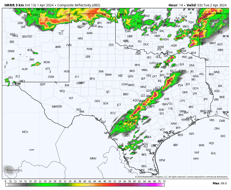
HRRR model radar forecast for 9pm today.
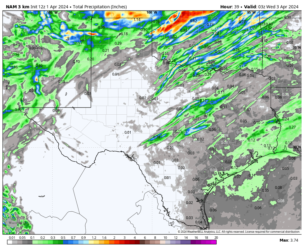
How much rain the latest NAM model is forecasting overnight…the other models are very similar.