Rain chances continue…models are blurry after Tuesday!
11-1-24. 4:45pm. This update is brought to you by Bahia Services and Rentals in Port O'Connor, TX https://www.facebook.com/BahiaServicesandRentals
Our wimpy cool front decided to turn around and move north overnight, leaving us with warmer than normal temps and humidity once again. The good news is that some areas have some liquid in their dust filled rain gauges over the past 48hrs. As of a few minutes ago, there are scattered pm poppers, mainly in south Texas. We will continue to see chances for rain in south-central and south Texas through Monday night. The best odds for severe weather and larger storms will be along the next front Monday afternoon.
After that, the models get blurry! A couple of them think a secondary front will move through later in the week and others that delay any cooler weather for several more days. At this point, it's hard to know what will happen...
We are hitting the road again tomorrow for a trip to Vegas to see one of our daughters for a week, so my posts may come at odd times, but I'll still try to get one out per day!
Have a great weekend.
Mark

This update is brought to you by Bahia Services and Rentals in Port O'Connor, TX https://www.facebook.com/BahiaServicesandRentals

Current radar.

48hr rainfall totals from the NWS

Yesterday's front has moved north as a warm front today.

Our next front (non-wimpy) will arrive Monday afternoon.

No threat to us for now, but bizarre to see a potential storm forming in the Carribean in November.

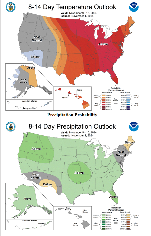
The models are looking blurry after Tuesday of next week! AI by Mark Langford
How much rain the latest models think will fall between today and next Friday, the 8th.