Cloudy and mild through Wednesday, with a chance for drizzle and showers.
12-14-24. 3pm. This Update is brought to you by Davy Ranch Supply in Yorktown, TX. davyranchsupply.com
For the holidays, some of our sponsors are letting me post a photo of them so you can see the faces behind the logos! Today it’s Davey Ranch Supply in Yorktown. We thank them for their gracious support. They sell livestock handling equipment such as squeeze chutes, adjustable alleys, crowding tubs, and scales. They also have a wide selection of gates and panels in stock to serve your specific needs. If they do not carry what you need, they do have customized options, too.
“Mostly Cloudy” is the key phrase for the next few days! A cool front is currently in the northern Hill Country and is expected to go poof over the next 12 hours. Drizzle and fog return to most areas tonight and we will see a repeat on Monday before another wimpy front tries to move through late in the day. This one will likely go stationary on a Del Rio to San Antonio line, so any cooling will be short-lived. Some showers and thunderstorms are possible along the frontal boundary, but as has been the case this season, I would not get your hopes up for much rain this week. Look for continued lows in the 60’s and highs in the 70’s. A seasonal front moves through on Wednesday giving us another chance for rain along the front, then clearing skies and cooler temperatures through Friday. We will see a return to upper 30’s and 40’s for lows and highs in the 50’s and 60’s on Thursday and Friday of next week.
The Euro model is forecasting a drizzly and warm Christmas as of today and the GFS is forecasting a warm and sunny Christmas. I have added Santa images to reflect the difference!
Still no arctic outbreaks in sight!
PS: I've been testing a way to send out my blogs from weather page website and I so far, I'm happy with "Follow It". Scroll down to the bottom of this page and you will see a place to subscribe to my blog. Within an hour of my posts, you should receive an email containing my post.
Mark

Ann and William Warwas from Davey Ranch Supply.
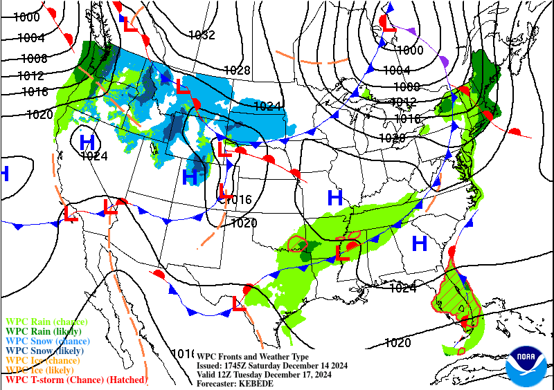
Monday’s wimpy front will go stationary by Tuesday morning, not really impacting our very mild temperatures very much. It will bring a chance for some scattered showers and thunderstorms on Monday.

Our next decent front will arrive late on Wednesday, giving us another chance for some scattered showers and thunderstorms. We should actually cool off behind this front!
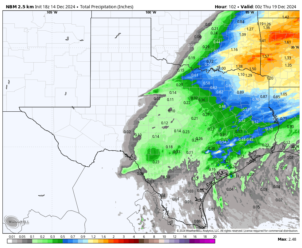
How much rain these models think will fall between today and next Wednesday. Click on images to see them larger.


The Euro model’s forecast for Christmas!

The GFS model’s forecast for Christmas!
The latest Christmas day model runs for high temperatures and rainfall. Click on images to see them larger.


