Cold air arrives tonight, then a chance for snow, sleet and freezing rain by Monday night and Tuesday!
1-18-25: 12:30pm This update is brought to you by: Davy Ranch Supply in Yorktown, TX. davyranchsupply.com
The cold front has moved through, but the really cold air won’t arrive until tonight. Not only will temperatures drop to the 20’s and 30’s by daybreak, but wind chills will drop into the teens for most of south-central Texas and 20’s in south Texas. Temperatures will warm into the 40’s on Sunday, then drop into the 20’s again by Monday morning. By Monday night, precipitation will start moving in and by Tuesday morning, many locations will see a mix of snow, sleet and freezing rain. The models are still keeping the heavier precipitation east of I-35, but most of south-central Texas should see a least a little snow during the night and early morning on Tuesday. Unlike 2021, temperatures will warm into the 40’s and 50’s by the end of the work-week.
Below are the latest model runs and advisories from the NWS.
Mark

This update is brought to you by: Davy Ranch Supply in Yorktown, TX. davyranchsupply.com


Sunday morning wind chills.


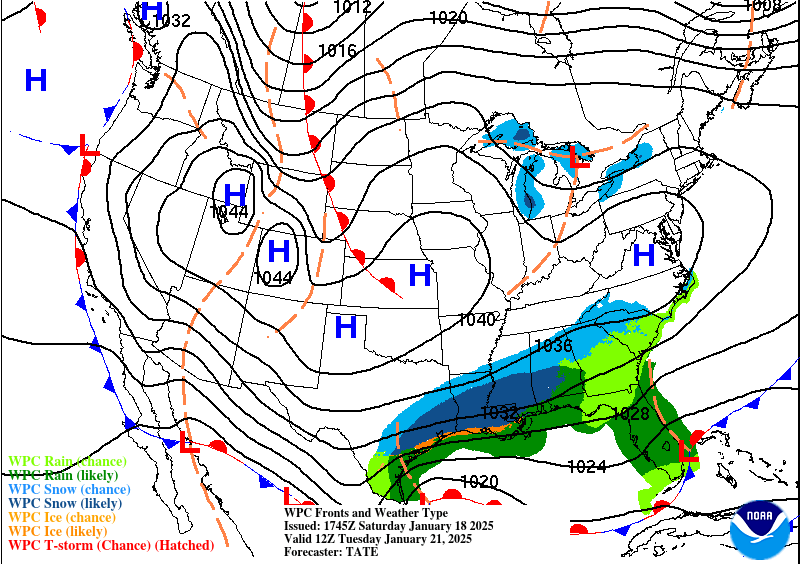
A coastal low will introduce moisture into the cold air on Monday night and Tuesday.
How much snow these models think will fall from Monday night through Tuesday. Click on images to see them larger.


How much ice these models think will fall from Monday night through Tuesday. Click on images to see them larger.


How much precipitation these models think will fall from Monday night through Tuesday. Click on images to see them larger.


Forecast lows from Sunday-Wednesday. Click on images to see them larger.


