It’s only the beginning!
7-22-24. 2:15pm. This Update is brought to you by Dietz-McLean Optical. www.dmoptical.com
With lots happening, let's focus on the short-range forecast in this update!
There have already been some big rains in the Hill Country this morning, with several stations reporting 2-3 inches. While most of the storms are forming just ahead or along the front, there are also storms forming in the coastal plains this afternoon as well. Look for the storms in the Hill Country to slowly move south as the front sags south...however, there could be a training of storms over the same area if the front does not move further south. Expect this pattern to stay in place for the next 48-72hrs. The rain won't end on Thursday, but odds will decrease somewhat.
We have Mesoscale Precipitation Discussion: #0693. Graphics are below, but here is what the NWS is saying: "Mesoscale Precipitation Discussion 0693
NWS Weather Prediction Center College Park MD
154 PM EDT Mon Jul 22 2024
Areas affected...much of southern, central, and eastern Texas
Concerning...Heavy rainfall...Flash flooding possible
Valid 221753Z - 222353Z
Summary...Widespread/numerous cell mergers are expected to produce brief heavy rain rates sufficient for flash flood potential
through 00Z this evening.
Discussion...With the onset of surface heating/destabilization,
scattered to numerous shower and thunderstorm activity has
materialized across the discussion area especially along and south
of a surface boundary extending from near Shreveport westward to
near Dryden (Terrell County), TX. Parts of this boundary have
been augmented by convective activity that has grown upscale into
small linear segments across west-central Texas.
The ongoing scenario should continue through the early evening,
with widespread thunderstorm development continuing. Multiple
cell mergers are expected to prolong rain rates and contribute to
spots of 2-3inch hourly amounts at times. These rates are likely
to cause excessive runoff in some areas."
Keep us posted on what's happening at your place and where!
Mark

This Update is brought to you by Dietz-McLean Optical. www.dmoptical.com
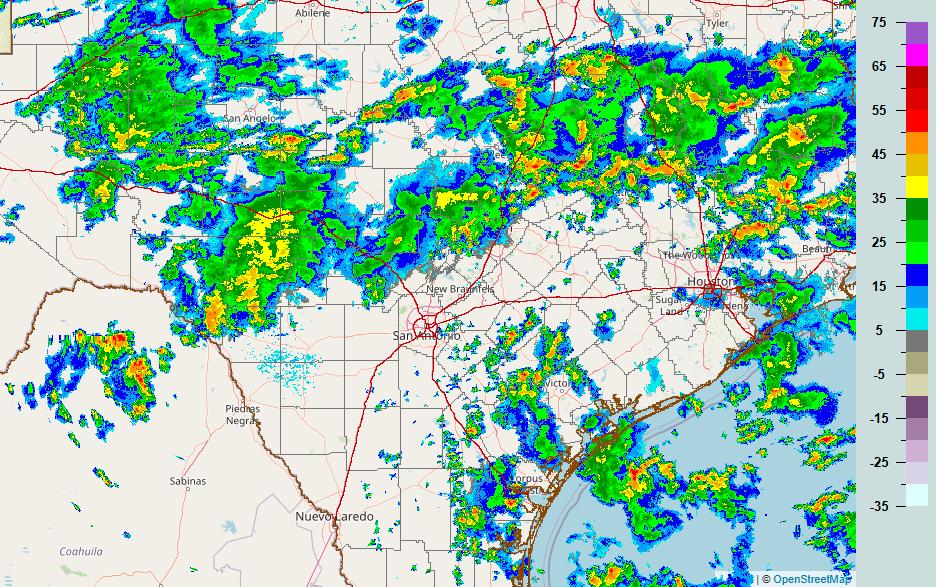
2pm radar.

Area where flash flooding could occur this afternoon and evening.


Current location of our cool front.
Click on images to see them larger. Excessive rain forecast for the next 3 days.


