Here we go!
5-4-24. 11:45am. This update is brought to you by Bahia Services and Rentals in Port O'Connor, TX https://www.facebook.com/BahiaServicesandRentals
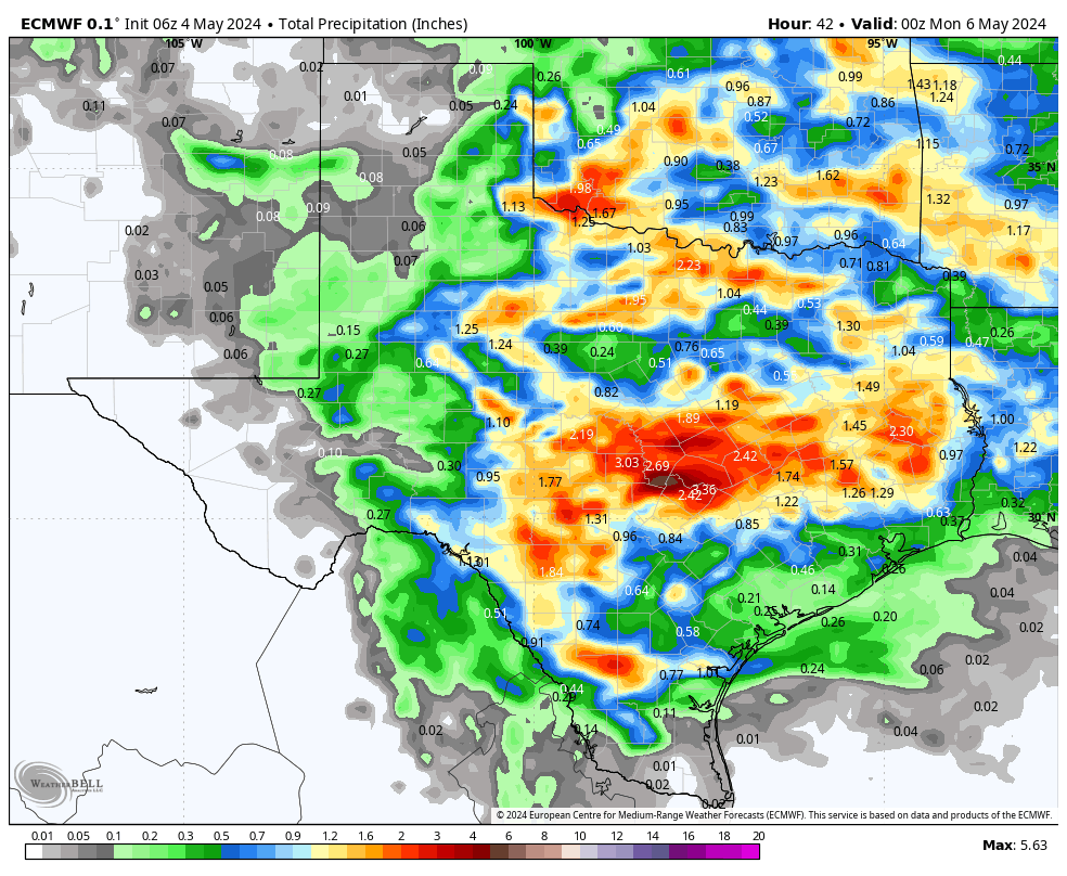
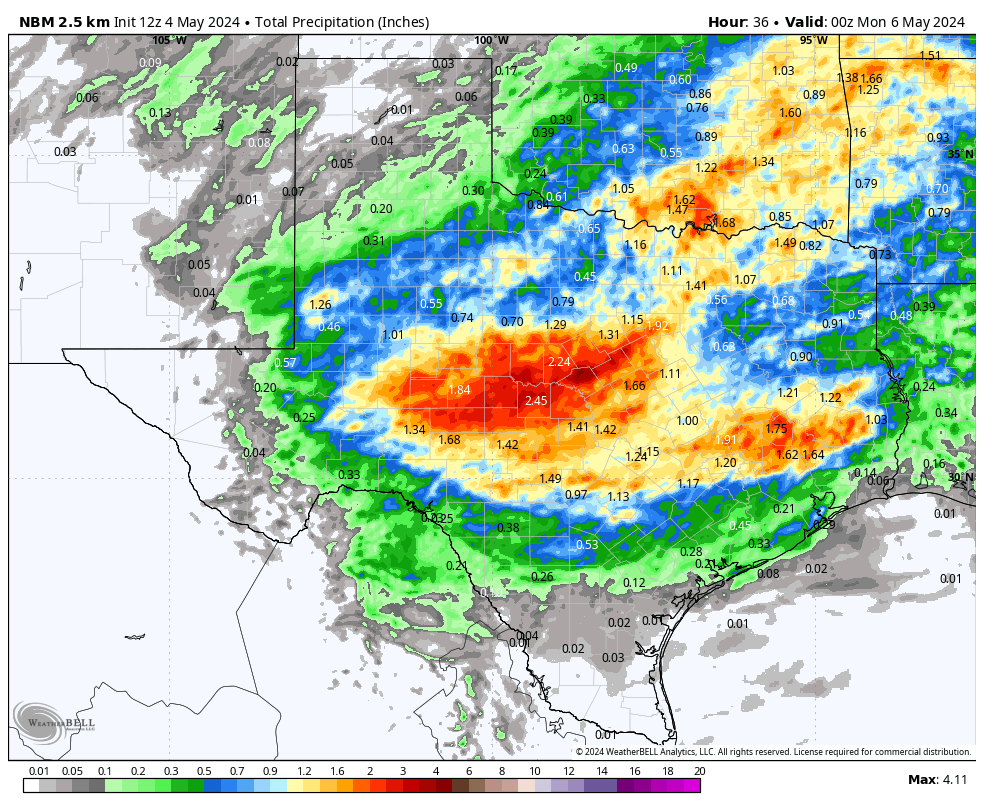
After looking at all of the latest model runs and reading the latest NWS discussions, this could be one of our best chances for widespread rain this year so far, for south-central Texas. As I have discussed over several posts this week, if you live south of a Del Rio to San Antonio to Houston line, your odds for rain will not be as good.
The NWS has now issued a Flood Watch for the northern counties of south-central Texas through Sunday morning. During the day today, there will be random poppers. After sunset, we should see a lot of activity in central and west Texas that will start moving SE into the Hill Country. By around midnight, those storms should start drifting into Austin and San Antonio, then eventually into the northern counties of south Texas (what is left of the storms). After a break, another wave of storms is forecast to move through on Sunday late morning. By Sunday afternoon, the storms should be well off to our east.
As is almost always the case in the spring, this will be a convective system, so there will be some areas that get 3 inches or more of rain and others that get little. I do think that most of you living along and north of HWY 90 and IH10 East line, should find at least a half of an inch of rain or more in your rain gauge by Sunday afternoon. At this point, I think the HRRR model has a good handle on our storms tonight and I'm hoping it verifies.
Not to be overlooked in my forecast...the storms today tonight and tomorrow have the potential to go severe, so please take precautions and tune into your local NOAA radio or emergency apps for instant warnings!
Lots of graphics and info below...
Mark

This update is brought to you by Bahia Services and Rentals in Port O'Connor, TX https://www.facebook.com/BahiaServicesandRentals
The latest graphics for the Flood Watch and Severe Weather. Click on an image to see it larger.


The latest model runs for rainfall totals from today through Sunday. Click on an image to see it larger.