Rain is on the way!
8-25-24. 1:45pm. This Update is brought to you by Bahia Services and Rentals in Port O'Connor, TX https://www.facebook.com/BahiaServicesandRentals
If we can't get a tropical something from the Gulf, why not a mid-level low (as defined by the Corpus Christi NWS) or and upper-level inverted trough (as defined by the SA-Austin NWS)...not sure why our NWS can't agree on what to call this!
As forecast by the GFS and Euro last week, this system formed from the base of a cool front over the SE last week and is now in the Gulf, to the east of us, with scattered storms moving into the coast and coastal plains as I post this update. The main convection is on the eastern side of the low. The low will continue to move to the west, giving most of our area a good chance for rain as very tropical air moves in from the Gulf. The low goes poof later this week out in west Texas but will be followed by a cool front taking a dive into Texas on Friday and Saturday. This front may or may not make it further south than central Texas, but will churn up our atmosphere for several days, with rain odds increasing as we move into Labor Day Weekend. With essentially no major high pressure over us, we will continue to see chances for rain through at least the first week of September!
Mark

This Update is brought to you by Bahia Services and Rentals in Port O'Connor, TX https://www.facebook.com/BahiaServicesandRentals

1:30pm radar.

1:30pm water vapor satellite imagery shows the low to the east of our coast.

Most of the convection is to the east of the low.

A cool front will take a dive into Texas on Friday and Saturday.

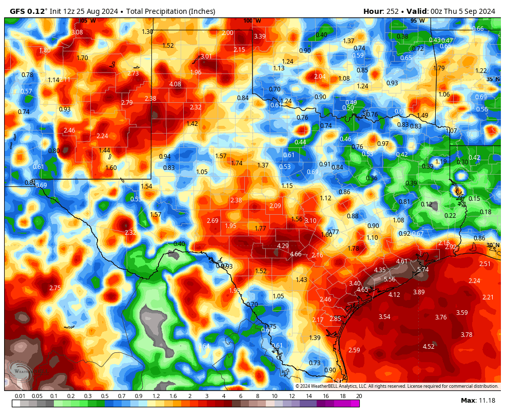
Click on images to see them larger. How much rain these models think will fall from today through 9-4.