Feeling great about our rain future!
6-12-24. 3:15pm. This Long-Range Update is brought to you by Dietz-McLean Optical. www.dmoptical.com
Before we dive into my long-range forecast, there are still quite a few storms lurking around our area this afternoon as seen on the latest radar imagery. Storms are training from Comal through Karnes counties as I work on this post! Victoria is also getting in on the action.
In the short term, there is a chance that a low pressure over Florida may turn into a tropical something in a few days, but it will be moving quickly to the NE, away from the USA. There is another area in the southern Gulf that also has a chance of becoming a tropical something, but for now appears to be drifting on a path that would lead it into Mexico. Here is the latest from the NHC: "A broad area of low pressure could form over the weekend across the southwestern Gulf of Mexico. Environmental conditions appear
conducive for some slow development early next week while the system moves slowly westward or west-northwestward.
* Formation chance through 48 hours...low...near 0 percent.
* Formation chance through 7 days...low...30 percent.
Looking further down the line, it is looking positive that high pressure will set up over the NE part of the USA, which sucks for them, but allows the trade winds to start bringing in copious quantities of moisture into Texas and the SW. This will jumpstart the monsoon for the west and allows for almost daily sea breeze storms to move in from the coast. It also puts us in a bullseye for any tropical systems as they will drift along the southern edge of the high pressure. I expect to start seeing this new pattern set up around the 20th and extend into at least early July.
Below are some various graphics and models, including the latest Gulf water temperatures, which continue to run above average...lots of fuel for future tropical systems!

This Long-Range Update is brought to you by Dietz-McLean Optical. www.dmoptical.com

2:45pm radar update. Cells are moving SE.

There is a 30% chance of this area developing into a tropical something over the next 7 days.

The latest Euro model shows where there is a chance for two tropical systems to form in the next 7 days.

The latest forecast for the low pressure over Florida.

The latest 8-14 day outlook from the CPC.
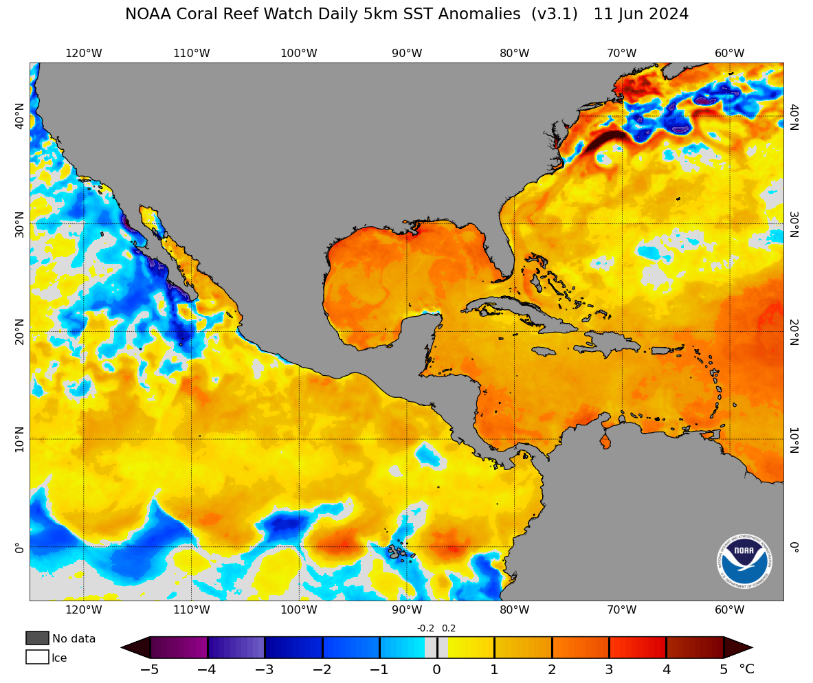
Current sea surface temperature anomalies.

Precipitable water anomaly from the latest GFS model for 28th. Green and blue are good!

How much rain the latest NBM model thinks will fall between today and the 23rd.