Severe weather threat on Friday and early Saturday…
4-3-25. 3:45pm. This short-range update is brought to you by Dietz-McLean Optical. www.dmoptical.com As a family-owned business, our independence, in house lab, great customer service and eyewear warranties, allows us to tailor your eyeglasses, lenses, and fittings: we want you to only expect the best after working with us. With six conveniently located optical shops in San Antonio, Boerne, Marble Falls and Temple, it’s easy to love what you see.
OK...not much to talk about today except for the heat! Lots of 90's out there right now and even some 100-degree temperatures being reported in south Texas. There could be some storms that form in the far northern counties of south-central Texas, but the odds are low.
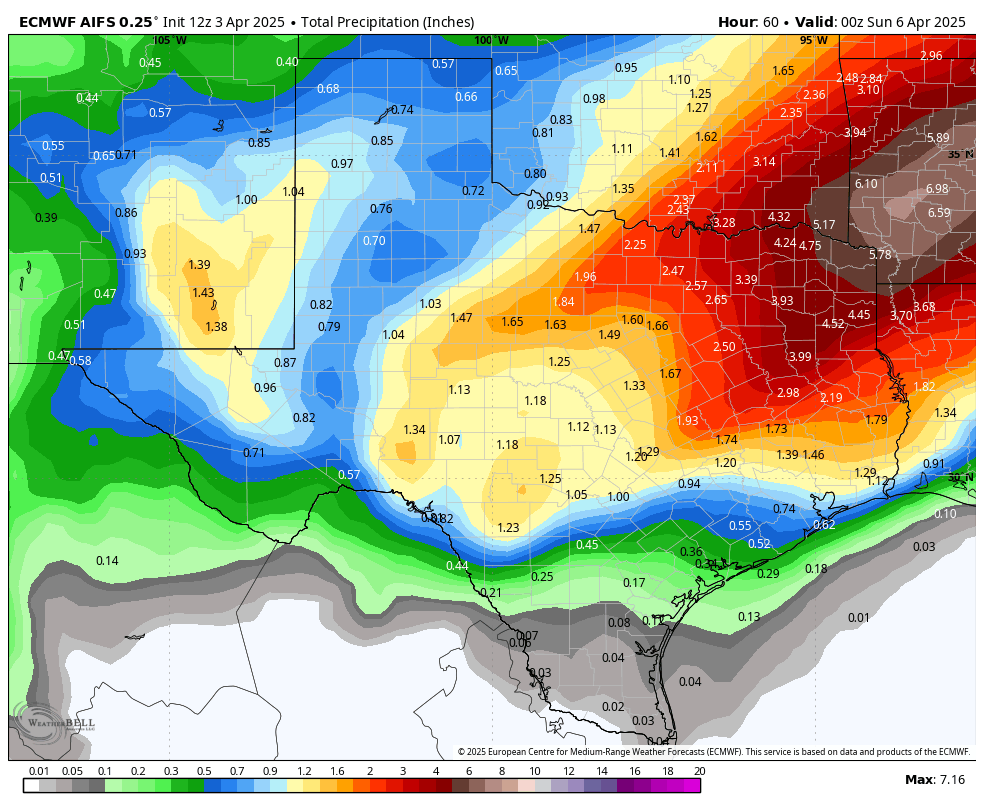
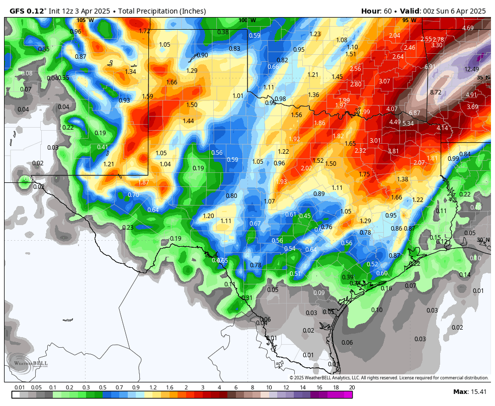
Things will certainly change tomorrow as the upper-level trough in the SW, moves eastward into north Texas. This will bring enough energy to the south to ignite scattered storms during the day, then a line of potentially severe storms during the evening as a strong cold front moves through Texas. Most of the activity will stay to the north of HWY 90 and I-10 East, but some of the models are sending storms to the south of HWY 90 in our western counties.
Below are all of the latest model runs and the latest Special Weather Statement from the NWS on timing and severe odds. FYI: The biggest threat from this system will be hail and high winds. As always, please tune into your local NOAA radio or emergency apps during severe weather events.
I've also included the depressing drought update that came out today...
Mark
This short-range update is brought to you by Dietz-McLean Optical. www.dmoptical.com As a family-owned business, our independence, in house lab, great customer service and eyewear warranties, allows us to tailor your eyeglasses, lenses, and fittings: we want you to only expect the best after working with us. With six conveniently located optical shops in San Antonio, Boerne, Marble Falls and Temple, it’s easy to love what you see.
High temperatures so far today!
The super depressing Drought Monitor graphic released today.
The latest update from the NWS on our potentially severe weather on Friday and early Saturday morning. Click on images to see them larger.
How much rain these models think will fall between today and Saturday. Click on images to see them larger.


