A strong front plus rain!
4-16-24. 6pm This update is brought to you by Davy Ranch Supply in Yorktown, TX. davyranchsupply.com
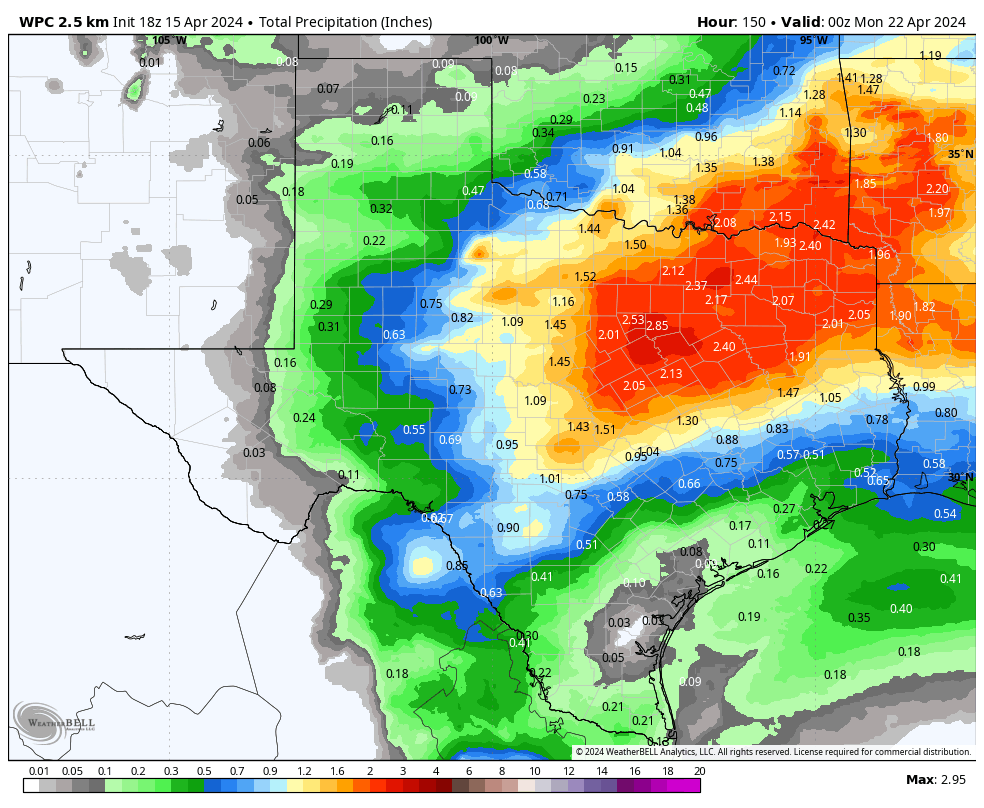
How do you like the possibility of a cold front and rain combo? While the future rain event will stay mostly to the north of HWY 90 and I-10E, it’s looking very promising for the drought plagued Hill Country. Here’s what the SA-Austin NWS is saying about Saturday: “By Saturday afternoon into the evening, the above mentioned cold front is forecast to push across the local area with periods of moderate to heavy rain and the potential for strong thunderstorms. The highest storm rainfall totals could end up being across the Hill Country with one to two inches per latest model guidance.”
A SW flow from the Pacific, surface moisture from the Gulf, a cold front and disturbances from a trough to our west will give south-central Texas a great shot of some decent rain mainly on Saturday and Saturday night. Rain odds start on Thursday night and end on Sunday with the passage of the cold front. Temperatures will remain on the hot side this week but cool down to the 70’s on Sunday with lows sliding down to the 50’s by Monday!

This update is brought to you by Davy Ranch Supply in Yorktown, TX. davyranchsupply.com

A slow-moving front will be the focus for showers and thunderstorms on Saturday and Saturday night.

Forecast lows for Monday!

Forecast highs for Monday!
How much rain the latest model runs think will fall from Thursday-Sunday.