One more day of rain chances!
6-11-24. 9:30am. This Rainfall Roundup and Update is brought to you by 5E Trailers in Marion. They’re here to help you find the perfect trailer at the best price! https://www.5etrailers.com/
The upper-level low will sweep across north Texas today, sending another impulse of energy our direction later this afternoon and evening. The latest HRRR radar simulation (which has done great lately) is forecasting a cluster of storms forming around a San Angelo to Brownwood line around 3pm, then moving southeast into our area around 6pm. The storms will make a run towards the coastal plains in the evening if they hold together. More scattered storms may form overnight and into Wednesday morning, before we start drying out. There is a chance some of the storms this afternoon and evening may go severe, with hail and high winds the primary threat. There is also a chance for heavy rain for those of you lucky to have one of the storms pass over you!
Below are the latest model runs and 2-day rainfall totals.
Mark

This Rainfall Roundup and Update is brought to you by 5E Trailers in Marion. They’re here to help you find the perfect trailer at the best price! https://www.5etrailers.com/
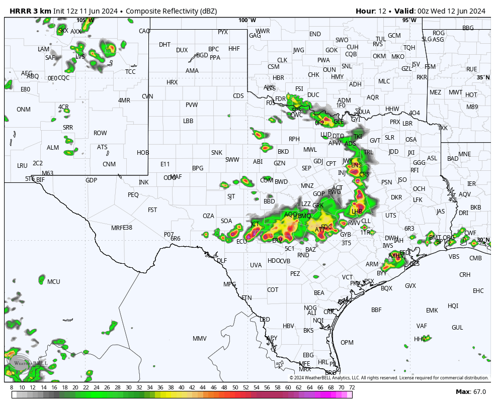
This is what the HRRR model thinks the radar will look like around 5pm this afternoon.
Click on images to see them larger. The latest severe weather forecast update.


Click on images to see them larger. 48hr rainfall totals for our area.


Click on images to see them larger. How much rain the latest model runs think will fall in the next 24hrs.


