So far, Beryl is reading my memos!
7-4-24. 1:30pm. This Tropical Update is brought to you by Dietz-McLean Optical. www.dmoptical.com
Happy 4th!
Well, so far Beryl is listening to me! The latest track forecast from the NHC has Beryl moving up the Rio Grande after moving into Mexico, just south of Brownsville on Monday morning. If this track stays steady, this puts the western counties and the Hill Country in a good position for some decent rain next week and of course, heavier amounts in south Texas and the coastal plains. FYI: We all know there is plenty of time for things to change, but for now, rain odds are looking good!
As far as how strong Beryl may end up being, the latest forecast is for it to become a Cat 1-2 storm as it gains strength in the Gulf. None of the models are currently growing it to a major hurricane...I hope this verifies!
On an interesting note, the reason Beryl will make a turn to the NW is because a rare summer trough will form over the plains this weekend, sending a cool front as far south as the northern counties of south-central Texas. This trough will tear apart the high pressure, leaving a small gap that will draw in Beryl. I have the graphics below along with the latest update and model runs.
Mark

This Tropical Update is brought to you by Dietz-McLean Optical. www.dmoptical.com

Happy 4th of July!

1pm Beryl update.

Projected tropical storm wind times and dates.

The latest spaghetti model runs.
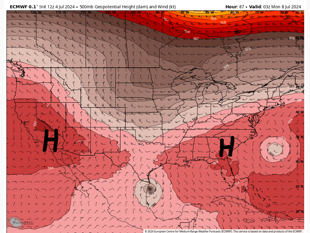
A trough will part our high pressure for a couple of days and allow Beyrl to have a pathway into northeastern Mexico and eventually Texas!
Click on images to see them larger. How much rain these models are forecasting from Beryl.


