Could be an interesting evening…
5-28-24. 9:30am. This update is brought to you by Jack Garrett and Phase II Fertilizer. Phase II, Inc. was founded in 1994 with a mission to Help Family Farmers & Ranchers Thrive. You can reach Jack at 361-275-4841.
This post will deal with weather over the next 24hrs...
A huge storm complex is hitting the Dallas area this morning, with flooding and high winds. This system will move SE today, missing our area, but sending some outflow boundaries that could produce some storms this afternoon for the northern Hill Country and along I-35.
Later this afternoon, a complex of storms will form in west Texas and the mountains of Mexico. These storms will move ESE during the evening and have a chance of dropping some heavy rain, hail and high winds. Since this will be convective in nature, it's hard to know who the rain lottery winners will be, but the Hill Country and western counties may see some beneficial rain this evening. The complex should continue to push ESE, eventually impacting border towns and the coastal plains by after midnight.
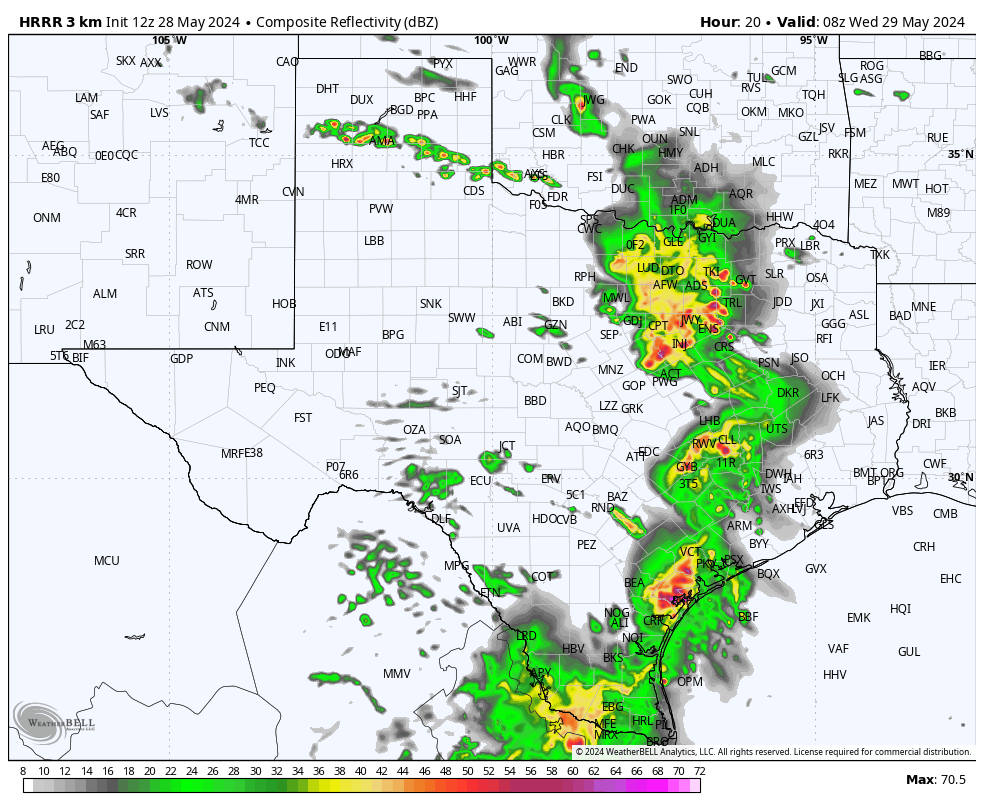
Below are the latest severe graphics and HRRR model radar forecast from 7pm-3am tomorrow. Remember that the radar imagery is what the model is forecasting but may not occur.
As always, please tune to your local NOAA radio or emergency apps for warnings.

This update is brought to you by Jack Garrett and Phase II Fertilizer. Phase II, Inc. was founded in 1994 with a mission to Help Family Farmers & Ranchers Thrive. You can reach Jack at 361-275-4841.
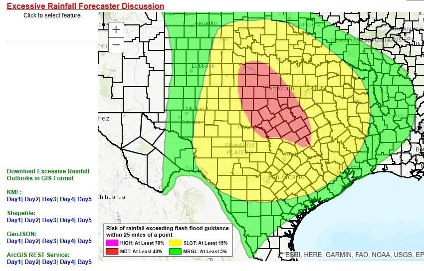
The latest severe weather and potential excessive rain graphics. Click on images to see them larger.


The latest HRRR model forecast radar graphics. Time is every two hours, from 7pm-3am. Click on images to see them larger.