Rain chances every day, starting on Halloween!
10-29-24. 4:30pm. This Update is brought to you by Jack Garrett and Phase II Fertilizer. Phase II, Inc. was founded in 1994 with a mission to Help Family Farmers & Ranchers Thrive. You can reach Jack at 361-275-4841.
A windy day out there this afternoon, with many locations recording 30mph gusts. A few of you may have had a brief passing streamer shower this morning, but for most, another warm and humid late October day.
As mentioned yesterday, that's all about to change as a wimpy front moves through the state on Halloween, stirring up some scattered showers and thunderstorms on Thursday-Saturday, before it retreats north as a warm front.
Over the weekend, our next low-pressure winds up over the west, increasing our rain odds ahead of our next real front that is forecast to blow through late Monday or Tuesday. This front will be the real deal with highs only in the 60's and low 70's on Wednesday! Along with the cool air will a better chance for rain ahead of and behind the front.
Looking even further down the line, it's looking like another system may move through later next week...I'll have more details on that as we get closer to the weekend.
While this won't be drought breaking rains like they will see in north Texas and OK, I'm still thinking that south-central Texas will see 1/2-1 inch rains and south Texas 1/4-1/2 inches.
Mark

This Update is brought to you by Jack Garrett and Phase II Fertilizer. Phase II, Inc. was founded in 1994 with a mission to Help Family Farmers & Ranchers Thrive. You can reach Jack at 361-275-4841.

Rainfall totals today so far…

High wind gusts so far today.
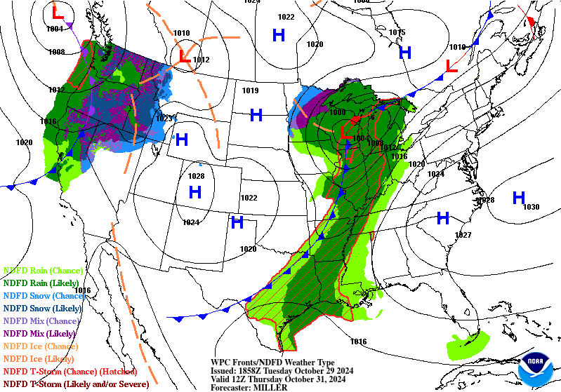
Cool front #1 will slowly move through the state on Halloween, giving us a chance for rain from Thursday-Saturday.
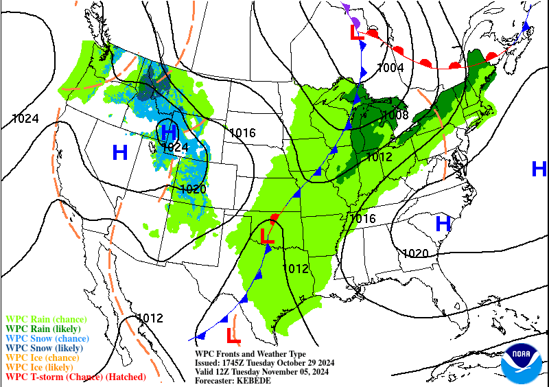
Cold front # 2 should arrive Tuesday of next week, giving us more chances for rain and dropping our highs into the 60's and 70's!

Forecast highs for next Wednesday!


How much rain the latest models think will fall between Halloween and next Friday. Click on images to see them larger.


