Total Eclipse update!
3-27-24. 1:30pm. This eclipse update is brought to you by Motor Carrier Safety Solutions in Laredo, TX. www.mcssinc.com
Nice to see that some of you got some rain today and looking at the latest radar imagery, there appears to be some new storms forming around Fredericksburg.
We are finally starting to get more model forecasts for April 8th and based on today’s runs, it’s going to be a nail biter! Fortunately, we are still 12 days out and as I have said in the past, long-range models should be taken with a grain of salt and a shot of tequila!
With that being said, here is what I’m seeing today. It appears now that a cold front will move through the eclipse zone on Monday morning, along with a line of showers and thunderstorms. This is a really creepy scenario because if the front arrives only 6-12 hours late, there will be clouds and rain during the time of the eclipse! Below are the latest cloud models for the 8th. I’ve switched over to the Pivotal Weather for their models because they show the eclipse path for the 8th. For their graphics, the greyer and bluer areas indicate cloud cover.

This eclipse update is brought to you by Motor Carrier Safety Solutions in Laredo, TX. www.mcssinc.com
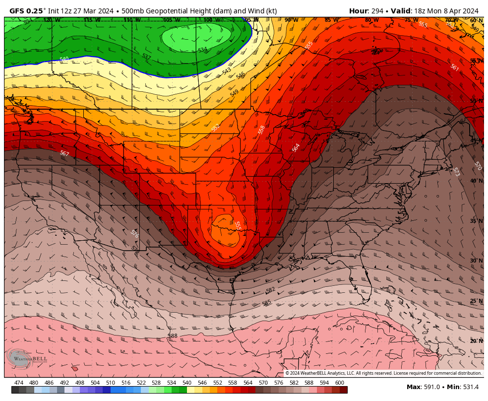
The GFS model is forecasting a strong trough (and cold front) to move through Texas on the 8th. This would mean a chance for showers and thunderstorms.
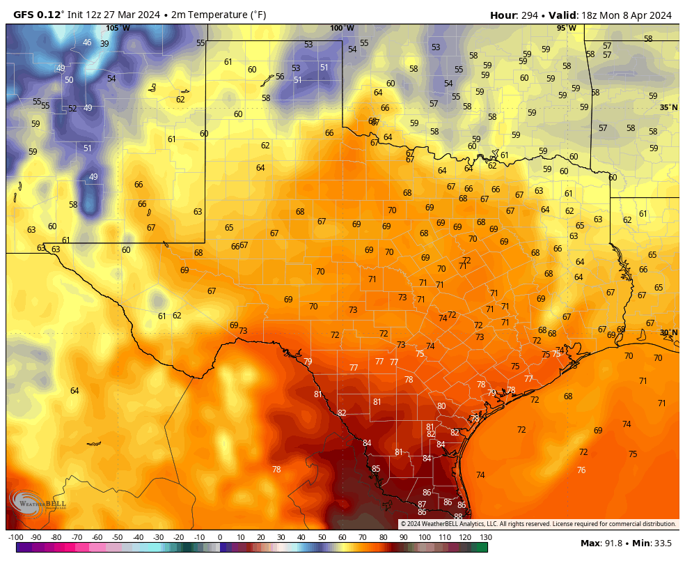
Forecast temperatures for the 8th from the GFS model.
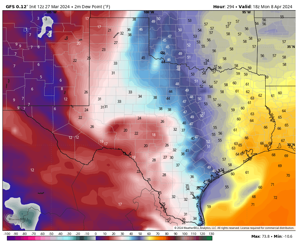
Dew point temperatures show that the GFS model thinks the front will have pushed through the eclipse zone by noon.
Here are the latest cloud forecasts from various models for noon on April 8th. The bluer the graphic, the more clouds that are being predicted.


