Rain falling on the western counties for a change!
7-9-24. 1:15pm. This Update is brought to you by 5E Trailers in Marion. They’re here to help you find the perfect trailer at the best price! https://www.5etrailers.com/
What a nice surprise! Despite Beryl snubbing our area and taking her rain east, we are enjoying thunderstorms from a mid-level shortwave in the western counties this morning and continuing into the afternoon! Movement of the storms is SE. We will continue with a chance for scattered storms through Friday, thanks to an eroded high over us.
Please post any rainfall totals and where your location is.
From the SA-Austin NWS:
...FLOOD ADVISORY IN EFFECT UNTIL 230 PM CDT THIS AFTERNOON...
* WHAT...Flooding caused by excessive rainfall is expected.
* WHERE...A portion of south central Texas, including the following
counties, Bandera and Kerr.
* WHEN...Until 230 PM CDT.
* IMPACTS...Minor flooding in low-lying and poor drainage areas.
* ADDITIONAL DETAILS...
- At 1231 PM CDT, Doppler radar indicated heavy rain due to
thunderstorms. Minor flooding is ongoing or expected to begin
shortly in the advisory area. Between 1 and 3 inches of rain
have fallen.
- Some locations that will experience flooding include...
Medina, Kerrville, Vanderpool, Tarpley, Ingram, Hunt,
Waltonia, Lost Maples State Natural Area, Kerr Wildlife
Management Area, Kerrville-Schreiner Park and Camp Verde.

This Update is brought to you by 5E Trailers in Marion. They’re here to help you find the perfect trailer at the best price! https://www.5etrailers.com/

1pm radar imagery. Storms are moving SE.

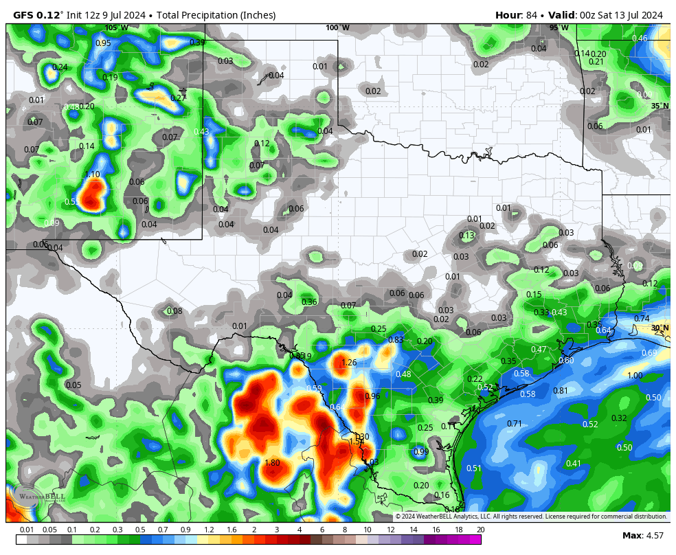
Excessive rain forecast for today.

Rainfall totals so far today.
How much rain the latest models think will fall between today and Friday. Click on images to see them larger.