My Pagosa Springs, CO monsoon forecast!
5-18-24. 1pm. This update is brought to you by Bahia Services and Rentals in Port O'Connor, TX https://www.facebook.com/BahiaServicesandRentals
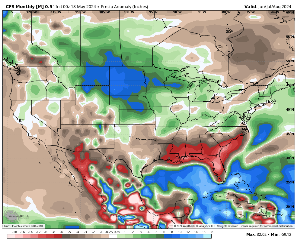
While this forecast is intended for where I live, in SW Colorado, some of the information is viable for Texas as well…especially the mountains in west Texas.
As with any long-range forecast, take this one with a grain of salt and a shot of Tequila…especially since it’s my forecast! Also, remember to view my predictions as entertainment more than what may or may not happen! Please don’t go out and buy cattle, plan outdoor weddings and events or book river rafting excursions based on this forecast!
Here we go! Based on several factors…current long-range models, sea temperatures and a transition from El Niño to La Niña within the next couple of months, here is what I am forecasting:
I predict a very active Atlantic hurricane season this year, with above normal storms. This will be due to transitioning into La Niña (which produces more storms due to lack of wind shear) and the fact that the Gulf and Atlantic will continue to see above normal ocean temperatures.
I predict normal to slightly above normal temperatures this summer for Pagosa Springs…a lot will depend on how much rain we get. As we all know, afternoon storms drop our temperatures dramatically.
With an active hurricane season and a warm Pacific, I think Pagosa Springs will see a slightly above normal monsoon season this year, with off and on weeks of rain starting in late June. The normal precipitation from July-September is 6.25 inches. My prediction for July-September is 8.25 inches of rain. As you can see in the model runs below, I am completely forecasting the opposite of what most of the long-range models are forecasting!

This update is brought to you by Bahia Services and Rentals in Port O'Connor, TX https://www.facebook.com/BahiaServicesandRentals

Current long-range model forecasts for June-September. Click on images to see them larger.


Current sea surface anomalies for the Atlantic, Gulf and eastern Pacific. Click on images to see them larger.

