Rain odds look good from Thursday through at least the next 10 days!
7-16-24. 4pm. This Update is brought to you by Dietz-McLean Optical. www.dmoptical.com
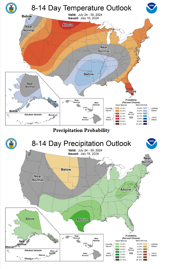
I know the graphics I am posting daily are starting to look pretty similar, but that is a good thing! We are still looking at a trough forming over the plains by Thursday and a wimpy front that will die over south-central Texas on Friday. The front will spark some scattered showers and thunderstorms, but the big change is the trough that will break up our summer high pressure and allow afternoon storms to form almost daily from Thursday through possibly the end of the month as I talked about yesterday. On top of that, we will see some disturbances to increase our rain odds as well. This is a very bizarre pattern for July and more similar to late September!
As always, don't focus too much on the rain totals at this point, just use the models as an overall indicator of a wet pattern ahead.
Still nothing in the tropics.
Mark

This Update is brought to you by Dietz-McLean Optical. www.dmoptical.com
Click on images to see them larger. How much rain these models are forecasting from Thursday through the 26th and the end of the month (GFS).