Still looking iffy on eclipse day…
4-4-24. 5:45pm. This eclipse update is brought to you by Bahia Services and Rentals in Port O'Connor, TX https://www.facebook.com/BahiaServicesandRentals
We are quickly closing on the total solar eclipse and unfortunately, not much has changed in the past week for cloud forecasts. Starting tomorrow, we will see several short-range models added to the list of forecasts, so I’m hoping for more than one of them to give us a more bullish outlook for Monday.
A quick disclaimer! I present the latest model runs and may share my personal opinions on what may or may not happen cloud wise on Monday, but if you are trying to make travel plans for the big day, you are on your own as far as making decisions on whether or not to spend money for lodging, etc. We may not know what will actually happen cloud wise until a few minutes before the eclipse happens! One thing I can assure everyone is the eclipse will happen and it will get dark!
From the SA-Austin NWS: "Dry and clearer conditions are forecast for Sunday behind the front,
though this will be short lived as the front stalls near the coast
and begins to move back northward as a warm front through Monday
morning. This is in response to a second, more southern stream
trough quickly moving into the Desert Southwest region. At the
surface, the low level moisture moving back to the north will likely
bring low stratus clouds for much of south-central Texas for at
least Monday morning while upper level Pacific moisture moves in
ahead of the eastward advancing trough, likely bringing in a deck of
cirrus clouds. The main questions remaining as far as eclipse
viewability is concerned is how thick the upper level cirrus deck is
and if the low level stratus will be able to scatter out in time for
totality. These are questions that will take some more time to
figure out with any certainty, but for now eclipse viewability
through the cloud cover is expected to be poor."
This eclipse update is brought to you by Bahia Services and Rentals in Port O'Connor, TX https://www.facebook.com/BahiaServicesandRentals

The latest forecast for where the front will be located on Monday morning is not good! We need it to be further south!
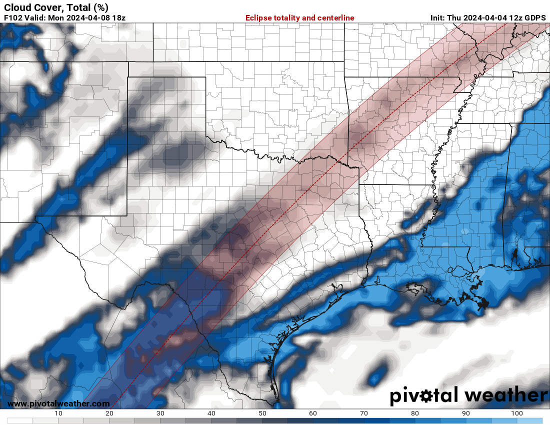
Here are the latest greatest cloud model forecasts for noon on Monday. I’m rooting for the GDPS (Canadian model)!