A quiet, but warm week ahead.
6-23-24. 2:45pm. This Update is brought to you by Dietz-McLean Optical. www.dmoptical.com
Our tropical disturbance is moving into Mexico this afternoon, sending some scattered poppers into south Texas and the LRGV. These will hang around the rest of the day, but by tomorrow there is only a slight chance for more to form. Some of the rainfall totals have been pretty decent, with one NWS reporting station in Nueces County recording over two inches of rain!
In the short term, high pressure will rule this week with lows in the 70's and highs in the 90's and lots of humidity! Heat indexes will likely be over 100 degrees every afternoon.
There continue to be signs that the high pressure over us will weaken and drift east by next weekend. While not a rain event, it would allow for afternoon sea breeze showers to form and temper our heat a little.
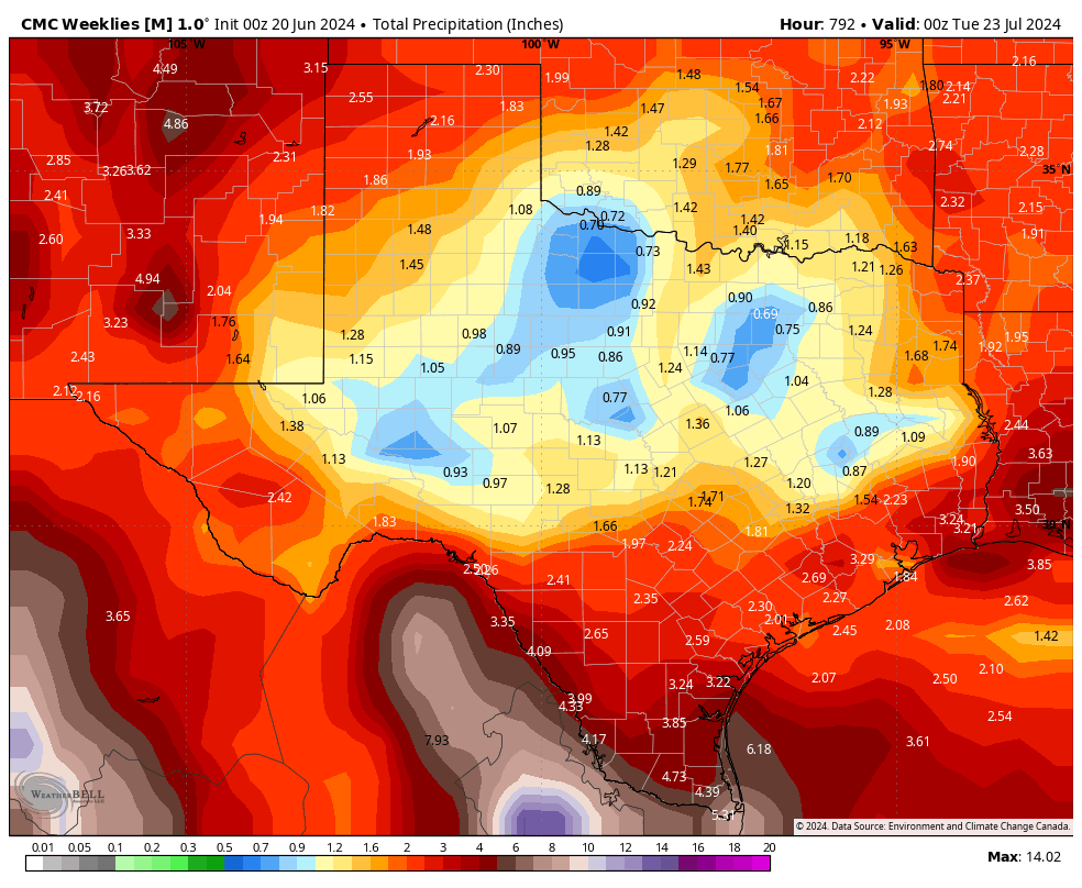
Below are some of the very long-range model runs for the next 30 days. As always, take these with a grain of salt and a shot of Tequila, but they do indicate we could have average rainfall in July. Of course, that could change dramatically, with another tropical system.
Enjoy the rest of your Sunday!
Mark

This Update is brought to you by Dietz-McLean Optical. www.dmoptical.com

2:30pm radar shows quite a few poppers roaming around south Texas and the LRGV.

24hr rainfall totals from the NWS.

It was a great week, rain wise for most of us. This graphic does not show far south Texas.
Click on images to see them larger. The latest model runs for 30day rainfall totals.


The latest 6-10day forecast gives us slightly better than 50/50 odds for above normal rainfall during that period.