Things are lining up nicely for rain next week!
7-20-24. 4:45pm. This Update is brought to you by Bahia Services and Rentals in Port O'Connor, TX https://www.facebook.com/BahiaServicesandRentals
As expected, there are some scattered PM Poppers roaming around western counties of south-central Texas and south Texas. Oddly, almost the same area north of Corpus is getting a storm just as it did yesterday!
A front will move into south-central Texas on Monday, then go stationary just south of an Eagle Pass to San Antonio line on Tuesday morning. This front and several disturbances will keep things active for at least a week.
This quote from the SA-Austin NWS sums things up for this week, "The entire long-term period out to Friday is full of elevated rain
chances as round after round of weak perturbations (disturbances) drift SE along the western edge of a broad trough over the Central US. This also will lead to below normal temperatures through the week as many of these rounds of thunderstorms will come with gusty outflows out of the north to behave as miniature reinforcements of a weak frontal zone that could be pinned as near stationary over the region by Tuesday."
Below are the latest greatest model runs and some other info.
Have a great Saturday night!
Mark

This Update is brought to you by Bahia Services and Rentals in Port O'Connor, TX https://www.facebook.com/BahiaServicesandRentals

5:30pm radar update.

Another rare July cool front will kick off our rain chances for next week when it goes stationary on Tuesday.
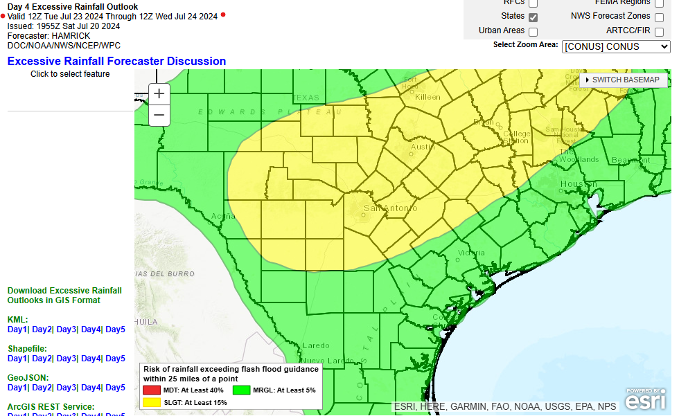
Click on images to see them larger. Where there is a chance for excessive rain next week.


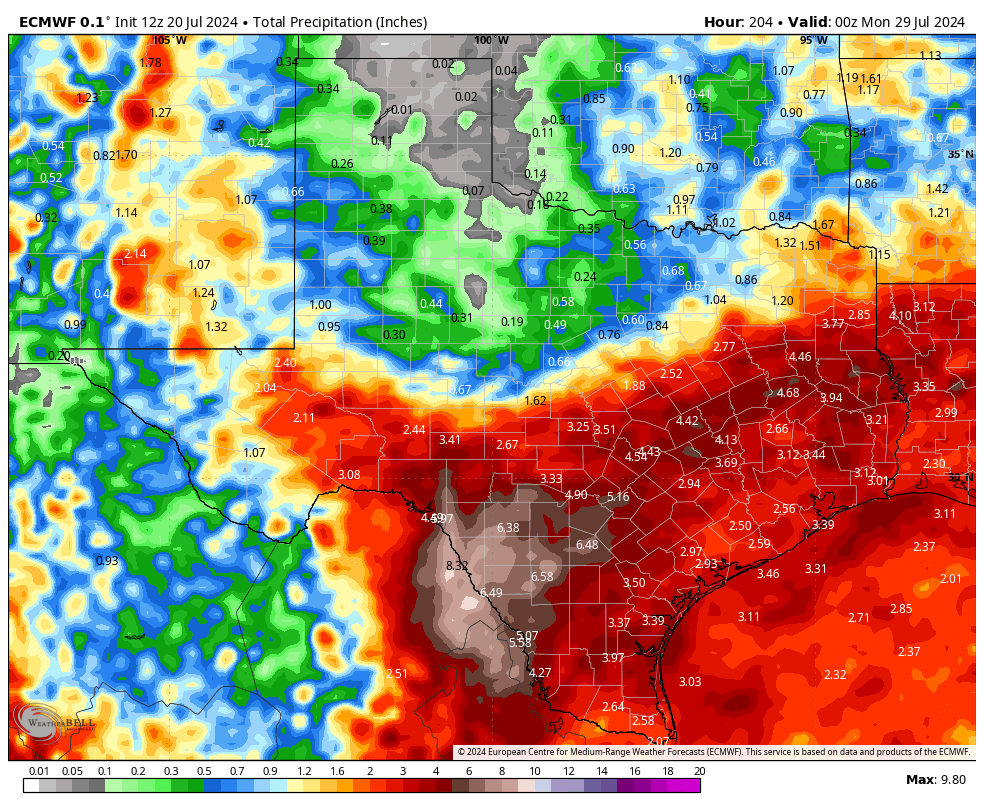
Click on images to see them larger. How much rain these models expect between tomorrow and next Sunday.


Looks like this pattern could continue through the rest of the month!