A slight chance for severe storms this afternoon…
3-21-24 1:30pm. This update is brought to you by Dietz-McLean Optical. www.dmoptical.com
Continued cloudy with a chance for wildly scattered storms this afternoon and evening as a trough approaches from the west.
From the NWS: "Scattered storms are forecast to develop between 5-7 PM over the Hill Country, and cross northern portions of the I-35 corridor and Coastal Plains through Midnight."
While there is still a chance for severe storms today and tonight, the Storm Prediction Center has downgraded our odds to "Marginal". The biggest threat will be hail and high winds. And while there is a chance that a few of you may hit the rain lottery as a scattered storm drifts over your place, unless you live to the east of I-35 and I-37, your odds for rain are low. As always, please tune to your NOAA radio or favorite emergency app to alert you to warnings for your area.
By midnight, drier air arrives, leading to a windy and warm day on Friday before our next front arrives Saturday morning.
Another cool front arrives Sunday night, giving us another chance for rain.
Mark

3-21-24 1:30pm. This update is brought to you by Dietz-McLean Optical. www.dmoptical.com


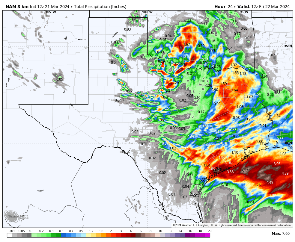
How much rain the models think will fall this afternoon through this evening…